Prime Minister Chris Hipkins is speaking to media after assessing flood damage and talking to locals around West Auckland this afternoon.
Hipkins will be joined by Auckland mayor Wayne Brown and Emergency Management Minister Kieran McAnulty in north west Auckland.
Hipkins says there are three confirmed deaths and one person still unaccounted for.
Watch a live stream, due to start at 3.15pm, here:
Follow all the latest news with RNZ's live blog here.
Unprecedented rain in Auckland, with more on the way
Following unprecedented rain for the Auckland region, MetService is warning of further rainfall for Auckland, although nothing is likely to match the severity of what has happened in the past 36 hours.
The MetService Red Heavy Rain Warning was lifted this morning and showers with the chance of thunderstorms are forecast for the remainder of the day (Saturday).
The State of Emergency still remains in force for the region.
There is a MetService Heavy Rain Watch in place for more rain on Sunday, from 6am until midnight.
"The main rain band has moved off to the east of Auckland for the time being and there are a number of Orange Warnings and Watches in place around the North Island," says MetService meteorologist Angus Hines.
"The main rain band returns to Auckland and Northland later on Sunday but rain will come and go for many areas in the North Island."
While the upcoming rain should not match the intensity of what has been, impacts are expected to be severe and wide reaching because of the saturated ground.
More flooding will occur through many northern regions in the coming days, and people should stay abreast of the latest information from local emergency management, Civil Defence and metservice.com.
Recap of Auckland's unprecedent rain event:
The exceptionally humid and rain-laden flow of air over the country bought widespread heavy rain on Friday to Auckland.
This combined with torrential localised downpours to produce the wettest day on record in our largest city.
Rain in Auckland began before sunrise on Friday, January 27, and there were steady falls through the day.
An Orange Heavy Rain Warning was active all day.
There was a risk of thunderstorms and downpours which began to come to fruition during the afternoon. Torrential downpours continued through the afternoon and MetService issued several Red Thunderstorm Warnings.
As these downpours continued to spread over Auckland, MetService and Auckland Council jointly made the decision to elevate the warning for the entire region to a Red Heavy Rain Warning.
"The rain that fell around the Auckland region was extreme and unprecedented," says Angus.
The weather station located at Auckland Airport has an unbroken record of weather observation since 1962 and prior to yesterday, the wettest ever day there amounted to 161.8mm of rain.
Yesterday that same site reported 245mm of rain, surpassing the previous record by over 50 per cent.
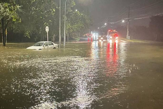
 Flooding in Auckland. Photo: RNZ.
Other weather stations all around the region also tallied remarkable rainfall, with many spots noting between 250-300mm of rain within the day.
Some stations reported over 80mm of rain in an hour.
To put this into context, the highest classification for intense rain we have at MetService is ‘torrential', which is defined as 40mm of rain or more in an hour.
As most people will have seen, this rain has led to widespread, severe flooding in the region.
Other areas:
Many areas in the North Island have also been drenched in the last few days. Some locations, such as the Coromandel Peninsula, Northland, and Gisborne are in the midst of their third heavy rain event of 2023.
"Due to the recent rains, it didn't take long before the impacts of the current severe weather began to rear up again.
"Slips, road closures and surface floods are common around much of Te Ika-a-Maui/North Island at the moment.
"People are advised to minimise travel where possible, and if you must travel, then check in with Waka Kotahi/NZTA to see the latest road closures."
Looking ahead through the weekend and into next week, more rain is on the way for drenched areas.
Drier weather looks to be on the way for the second half of next week after these rainy days.


0 comments
Leave a Comment
You must be logged in to make a comment.