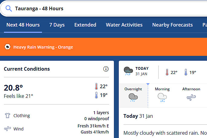
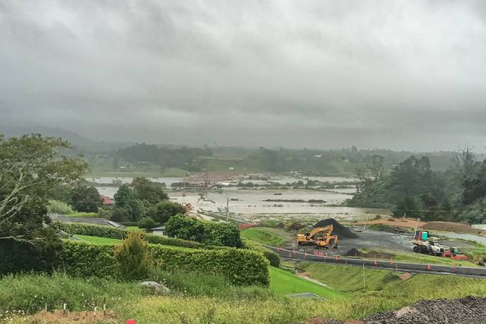
An orange warning for heavy rain remains in force for the Bay of Plenty.
In an updated statement today, the MetService says further heavy rain is expected for northern New Zealand along with possible severe gale northeasterlies.
"A strong and humid northeast flow covering the North Island spreads south over the rest of the country during Wednesday," says a spokesperson for the weather organisation.
"Bursts of heavy rain and thunderstorms are likely for a number of North Island regions through into Thursday, especially with an embedded front that is forecast to move slowly southeastwards over northern New Zealand.
"Rain spreads onto northern and western parts of the South Island on Wednesday, and continues into Friday."
Red heavy rain warnings are in place for Northland, Auckland north of Orewa and Coromandel Peninsula.
Orange heavy rain warnings are in place for Auckland from Orewa southwards, Great Barrier Island, Bay of Plenty and northern Gisborne.
Heavy rain watches are now in place for Waikato, Mount Taranaki, northwest Tasman and Westland.
A watch for severe northeast gales is also in place for Northland and Auckland, with large waves affecting eastern coastlines, says the MetService.
"People are advised to keep up to date with the latest forecasts in case any changes are made, or further areas are added."
 Image: MetService.
Heavy Rain Warning - Red
This rain is expected to cause dangerous river conditions and significant flooding. Slips and floodwaters are likely to disrupt travel, making some roads impassable and possibly isolating communities.
Area: Northland
Valid: 19 hours from 9am Tue 31 Jan to 4am Wed 1 Feb
Forecast: Expect 100 to 140 mm of rain in the north and east, with lesser amounts in the west. However, localised areas may receive 140 to 220 mm. Peak rates of 10 to 20 mm/h, mainly in the north and east, but localised areas may see 25 to 40 mm/h, or possibly more. Thunderstorms are also possible, and a Severe Thunderstorm Watch is also in force.
Area: Auckland north of Orewa
Valid: 15 hours from 5pm Tue 31 Jan to 8am Wed 1 Feb
Forecast: Expect 80 to 120 mm of rain. Peak rates of 10 to 20 mm/h, but localised areas may see downpours of 25 to 40 mm/h. Thunderstorms are also possible.
Area: Coromandel Peninsula
Valid: 17 hours from 10pm Tue 31 Jan to 3pm Wed 1 Feb
Forecast: Expect 100 to 150 mm of rain about the ranges, with lesser amounts about the coast. Peak rates of 15 to 25 mm/h, especially about the ranges. Thunderstorms are also possible.
Heavy Rain Warning - Orange
Heavy rain may cause streams and rivers to rise rapidly. Surface flooding and slips are also possible and driving conditions may be hazardous.
Area: Auckland from Orewa southwards, and Great Barrier Island
Valid: 14 hours from 8pm Tue 31 Jan to 10am Wed 1 Feb
Forecast: Expect 50 to 80 mm of rain, especially north of the Harbour Bridge. Peak rates of 10 to 20 mm/h, but localised areas may see downpours of 25 to 40 mm/h. Thunderstorms are also possible.
Area: Bay of Plenty west of Whakatane
Valid: 18 hours from 3am Wed 1 Feb to 9pm Wed 1 Feb
Forecast: Expect 100 to 150 mm of rain. Peak rates of 15 to 25 mm/h.
Area: Bay of Plenty about and east of Whakatane, also Gisborne north of Ruatoria
Valid: 21 hours from 1pm Wed 1 Feb to 10am Thu 2 Feb
Forecast: Expect 100 to 120 mm of rain, with the largest amounts likely about Gisborne north of Ruatoria.


0 comments
Leave a Comment
You must be logged in to make a comment.