Garry says with the storm approaching faster than previously thought, emergency services have had to push forward safety plans for the region.
He says heavy rain and winds of up to 140 km per hour were expected to lash the region on Sunday afternoon, instead of Monday, as first thought.
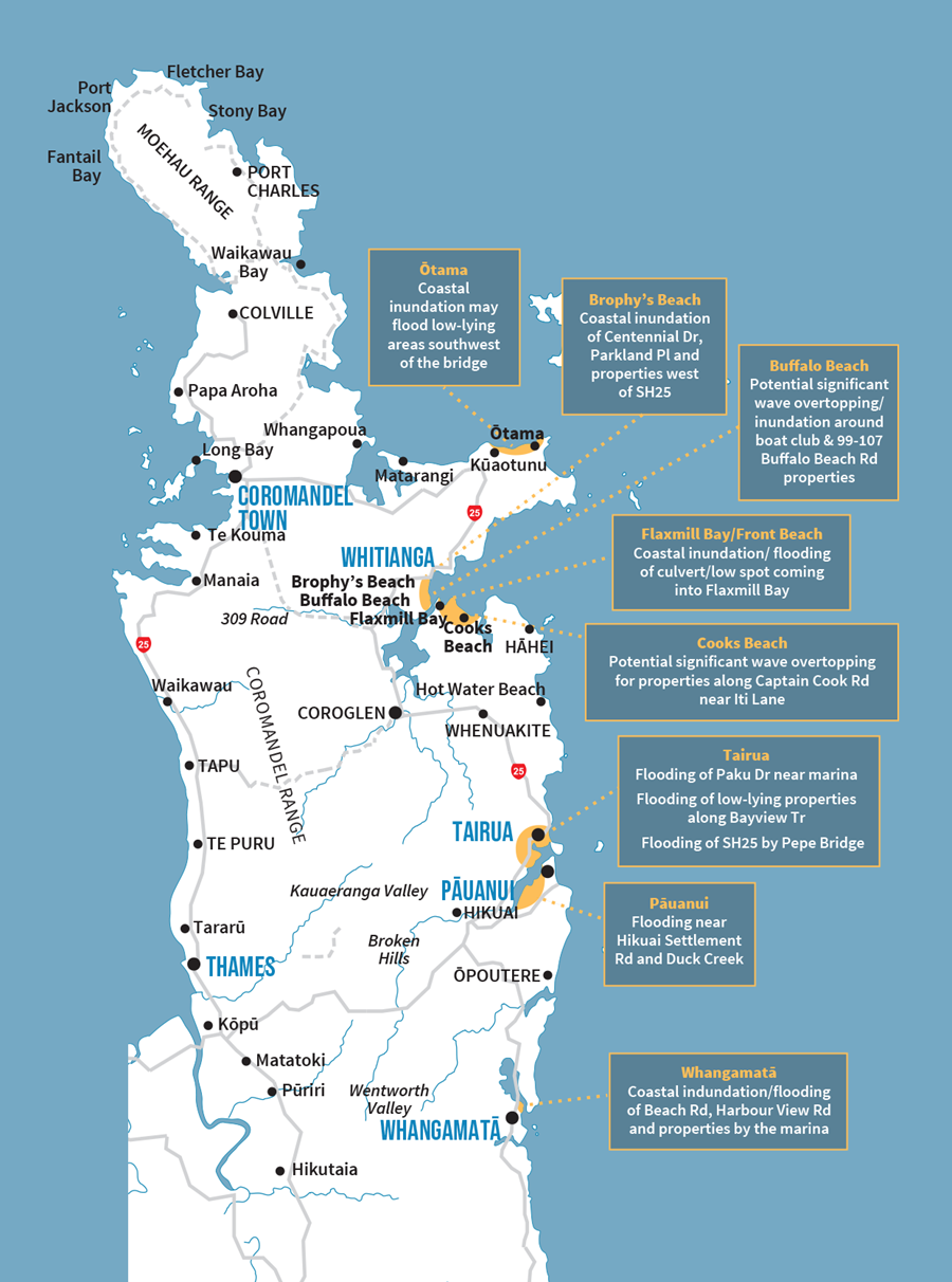
Garry asks people living in areas prone to flooding or in areas that could be inundated with coastal surges – specifically at Ōtama, Brophy's Beach, Buffalo Beach, Flaxmill Bay and Front Beach, Cook's Beach, Tairua, Pāuanui and Whangamatā – to review their situation and leave if they felt unsafe.
'We need you to take this seriously and consider self-evacuation.”
'Think about evacuating, think about a plan, take your medications, take food and whatever you need now, before we have to came and evacuate you," says Shame.
'It's going to have a severe impact, so please take this seriously and make sure you are somewhere safe by Sunday night.”

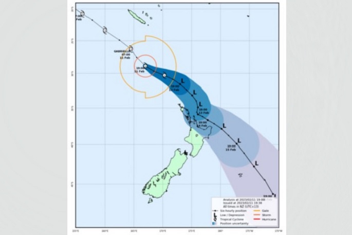
MetService has just released a new batch of warnings, as Cyclone Gabrielle gets closer.
All of Auckland has been upgraded from a strong wind watch, to a strong wind warning, with gusts likely to reach 120-130 km per hour from Monday.
The Waikato, Bay of Plenty and Taupo have all been upgraded to warnings as well.
There is also now a heavy rain watch for the Bay of Plenty and eastern Taupo.
'Expect periods of heavy easterly rain, mostly in Bay of Plenty West of Kawerau, and about the eastern ranges of Bay of Plenty and Taupo," says a MetService spokesperson.
'Rainfall accumulations may approach warning criteria.”
Extra fire and emergency specialist and technical resources would be deployed to the communities most likely to need an extra hand during the cyclone, a Fire and Emergency New Zealand spokesperson said.
FENZ confirmed their Urban Search and Rescue squads would be in the field - they're equipped for light rescue and rapid damage assessment.
'We are also deploying teams skilled in water rescues, others who work with drones, plus paramedics and engineers.”
The teams will be based in Kaitaia, Whangarei, Auckland, the Coromandel and Gisborne.
'They will be supporting our local fire crews to do what they do best - help you when you need us.”
High winds to hit northern part of New Zealand first
MetService Meteorologist John Law says the northern parts of the country will be the first to experience the high winds, with gusts of up to 120-130 km per hour.
Northland and Auckland from 7am on Sunday could expect to see those high winds, with exposed areas such as Whangaparoa and Great Barrier Island likely to get hit the worst.
Those winds could last right through until Tuesday, says John.


0 comments
Leave a Comment
You must be logged in to make a comment.