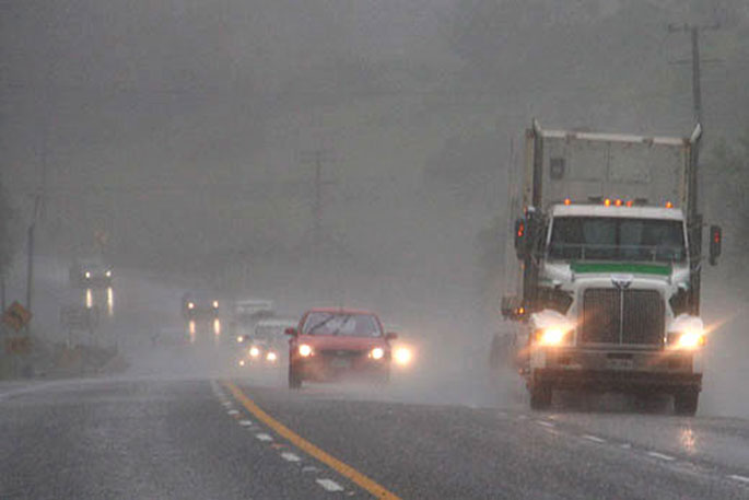
Heavy rain and north to northwest gales are forecast for parts of central and southern New Zealand over the next few days says MetService. This includes the Bay of Plenty ranges east of Opotiki
A complex low pressure system is expected to approach New Zealand from the northwest later today, and then cross the country on Friday and Saturday.
This system is preceded by a strengthening and moist northerly flow, and is followed by unsettled west to northwest winds.
Warnings and Watches are in place over southern and central parts of the country for Heavy Rain and Severe Gales.
Warnings for Heavy Rain have now been added for the Tararua Range and Mount Taranaki, as well as Heavy Rain Watches for the Central Plateau of the North Island and the eastern Bay of Plenty ranges. A Watch is now also in force for severe northerly gales for South Taranaki and Whanganui.
People are advised to keep up to date with the latest forecasts in case any changes are made, or more areas added.
Heavy Rain Watch
Area: Bay of Plenty ranges east of Opotiki
Valid: 13 hours from 10:00pm Fri 17 Mar to 11:00am Sat 18 Mar
Forecast: Periods of heavy rain. Rainfall amounts may approach warning criteria.
Area: Central plateau of the North Island from Tongariro National Park to the Kaimanawa Range
Valid: 14 hours from 11:00am Fri 17 Mar to 1:00am Sat 18 Mar
Forecast: Periods of heavy rain. Rainfall amounts may approach warning criteria.
Area: The Richmond and Bryant Ranges including the Rai Valley area, and the Marlborough Sounds
Valid: 9 hours from 10:00pm Thu 16 Mar to 7:00am Fri 17 Mar
Forecast: Periods of heavy rain. Rainfall amounts may approach warning criteria.
Area: Buller
Valid: 30 hours from 7:00pm Thu 16 Mar to 1:00am Sat 18 Mar
Forecast: Periods of heavy rain. Rainfall amounts may approach warning criteria. Thunderstorms possible.
Area: Southland, Clutha, and Fiordland about and south of Dusky Sound
Valid: 12 hours from 5:00pm Thu 16 Mar to 5:00am Fri 17 Mar
Forecast: Periods of heavy rain. Rainfall amounts may approach warning criteria.
Area: Queenstown Lakes District away from the Otago headwaters, and Central Otago
Valid: 11 hours from 5:00pm Thu 16 Mar to 4:00am Fri 17 Mar
Forecast: Periods of heavy rain. Rainfall amounts may approach warning criteria.
Area: Headwaters of the Otago lakes and rivers
Valid: 20 hours from 4:00pm Thu 16 Mar to 12:00pm Fri 17 Mar
Forecast: Periods of heavy rain. Rainfall amounts may approach warning criteria within 15 km east of the main divide.
Strong Wind Watch
Area: Wairarapa south of Masterton
Valid: 9 hours from 1:00am Fri 17 Mar to 10:00am Fri 17 Mar
Forecast: Northwest winds may approach severe gale at times.
Area: South Taranaki and Whanganui
Valid: 6 hours from 12:00am Fri 17 Mar to 6:00am Fri 17 Mar
Forecast: Northerly winds may approach severe gale at times.
Area: Buller and Westland
Valid: 9 hours from 6:00pm Thu 16 Mar to 3:00am Fri 17 Mar
Forecast: Northerly winds may approach severe gale at times.
Area: Banks Peninsula
Valid: 6 hours from 1:00am Fri 17 Mar to 7:00am Fri 17 Mar
Forecast: Northeast winds may approach severe gale at times.


0 comments
Leave a Comment
You must be logged in to make a comment.