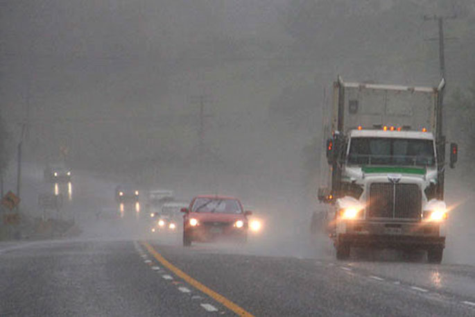
MetService has issued a Severe Weather Watch for Rotorua and the Western Bay of Plenty. A Heavy Rain warning is also in place for the Bay of Plenty east of Whakatane.
A complex low pressure system will move across the country today and during Saturday, says a MetService spokesperson.
"This system is preceded by a strong and moist northerly flow, and followed by unsettled west to northwesterlies." Warnings and Watches for heavy rain and severe gales are in place for many areas. People are advised to keep up to date with the latest forecasts in case any changes are made, or more areas added.
Heavy Rain Watch Area: Bay of Plenty west of Whakatane, and Rotorua Valid: 19 hours from 4:00pm Fri 17 Mar to 11:00am Sat 18 Mar Forecast: Periods of heavy rain. Rainfall amounts may approach warning criteria. Area: Central plateau of the North Island from Tongariro National Park to the Kaimanawa Range Valid: 20 hours from 11:00am Fri 17 Mar to 7:00am Sat 18 Mar Forecast: Periods of heavy rain. Rainfall amounts may approach warning criteria. Please note that the period has been extended till Saturday morning. Area: Buller Valid: 14 hours from 9:00am Fri 17 Mar to 11:00pm Fri 17 Mar Forecast: Rain with heavy falls, especially from this afternoon, with thunderstorms. Rainfall amounts may approach warning criteria. Area: Headwaters of the Otago lakes and rivers Valid: 3 hours from 9:00am Fri 17 Mar to 12:00pm Fri 17 Mar Forecast: Periods of heavy rain. Rainfall amounts may approach warning criteria within 15 km east of the main divide. Strong Wind Watch Area: Wairarapa south of Masterton Valid: 2 hours from 9:00am Fri 17 Mar to 11:00am Fri 17 Mar Forecast: Northwest winds may approach severe gale at times.
Heavy Rain Warning Heavy rain may cause streams and rivers to rise rapidly. Surface flooding and slips are also possible and driving conditions may be hazardous. Area: Bay of Plenty east of Whakatane Valid: 19 hours from 4:00pm Fri 17 Mar to 11:00am Sat 18 Mar Forecast: Expect 80 to 100mm of rain. Peak rates of 15 to 25 mm/h expected overnight and Saturday morning. Area: Tararua Range Valid: 21 hours from 9:00am Fri 17 Mar to 6:00am Sat 18 Mar Forecast: Expect 80 to 120 mm of rain. Peak rainfall rates of 15 to 25 mm per hour. Please note, that rain should ease this afternoon then reintensify late evening. This Warning has therefore been extended. Area: Mount Taranaki Valid: 20 hours from 9:00am Fri 17 Mar to 5:00am Sat 18 Mar Forecast: Expect 200 to 250 mm of rain. Peak rainfall rates of 15 to 25 mm per hour. Please note, that rain should ease this afternoon then reintensify late evening. This Warning has therefore been extended. Area: Westland Valid: 11 hours from 9:00am Fri 17 Mar to 8:00pm Fri 17 Mar Forecast: Expect another 100 to 150 mm of rain in the ranges, but possibly 200 mm near the Glaciers, and 50 to 80 mm near the coast. Peak rainfall rates of 25 to 35 mm per hour about the ranges later this morning, with occasional thunderstorms. Please note, that rain is expected to ease south of the Glaciers by 4pm today, and by 8pm in the north. Area: Fiordland north of Dusky Sound Valid: 3 hours from 9:00am Fri 17 Mar to 12:00pm Fri 17 Mar Forecast: Expect another 20 to 40 mm of rain, in addition to what has already fallen. Peak rainfall rates of 15 to 30 mm per hour. Thunderstorms possible. Area: The headwaters of the Canterbury lakes and rivers about and south of Arthurs Pass Valid: 11 hours from 9:00am Fri 17 Mar to 8:00pm Fri 17 Mar Forecast: Expect another 100 to 150 mm of rain on the main divide, and 60 to 100 mm within 15 km east of the divide. Peak rainfall rates of 20 to 30 mm per hour later this morning, with occasional thunderstorms. Strong Wind Warning Strong wind gusts could damage trees, powerlines and unsecured structures. Driving may be hazardous, especially for high-sided vehicles and motorcycles. Area: Canterbury High Country Valid: 9 hours from 9:00am Fri 17 Mar to 6:00pm Fri 17 Mar Forecast: Severe north to northwest gales in exposed places, gusting 120 km/h.


0 comments
Leave a Comment
You must be logged in to make a comment.