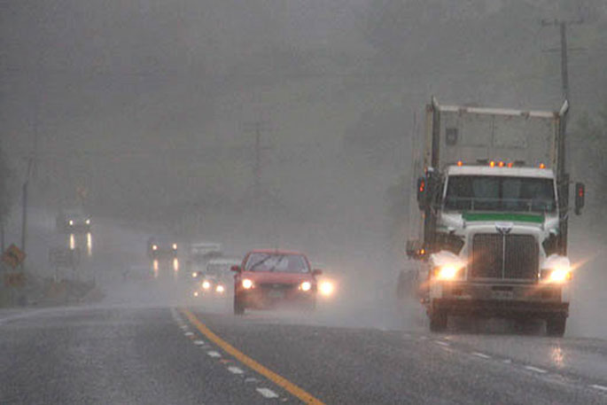
Metservice has issued a Severe Weather Warning with heavy rain forecast for parts of the upper North Island and the west of the South Island. Severe gales are also possible for southern Westland.
An active front associated with a subtropical low moves south over the upper North Island today, then onto central New Zealand on Tuesday, bringing periods of heavy rain to some places.
The low is forecast to approach the west of the lower South Island on Tuesday, then spreads a strong and humid northwest flow across the South Island as it moves away to the south later Tuesday.
Fronts embedded in this flow are expected to bring periods of heavy rain to the west of the South Island during Tuesday and Wednesday.
Warnings and Watches for heavy rain and are in force for parts of the upper North Island and the west of the South Island. In addition, a Strong Wind Watch is in force for southern Westland.
Please keep up to date with the latest forecasts in case any changes are made or more areas are added.
Heavy Rain Warning is in place for these regions:
Area: Coromandel Peninsula
Valid: 9 hours from 9:00am Mon 1 May to 6:00pm Mon 1 May
Forecast: Expect a further 40 to 70 mm of rain to accumulate about the ranges on top of what has already fallen, with lesser amounts elsewhere. Peak rates of 10 to 20 mm/h.
Area: Bay of Plenty west of Kawerau, including Rotorua
Valid: 17 hours from 9:00am Mon 1 May to 2:00am Tue 2 May
Forecast: Expect a further 70 to 100 mm of rain on top of what has already fallen about the ranges, with lesser amounts elsewhere. Peak rates of 10 to 20 mm/h about the ranges.
Note: Another period of heavy rain is possible late Tuesday and Wednesday, and a Watch or Warning may be issued closer to the time.
Area: Bay of Plenty east of Te Kaha and Gisborne north of Tokomaru Bay
Valid: 24 hours from 8:00pm Mon 1 May to 8:00pm Tue 2 May
Forecast: Expect 100 to 150 mm of rain, mainly about the ranges. Peak rates of 10 to 20 mm/h.
Area: Tasman northwest of Motueka
Valid: 24 hours from 5:00pm Mon 1 May to 5:00pm Tue 2 May
Forecast: Expect 100 to 140 mm of rain, mainly in the ranges. Peak rates of 10 to 20 mm/h.
Area: Westland south of Otira
Valid: 39 hours from 6:00am Tue 2 May to 9:00pm Wed 3 May
Forecast: Expect 300 to 400 mm of rain in the ranges, and 100 to 150 mm nearer the coast. Peak rates of 15 to 25 mm/h in the ranges, but possibly up to 35 mm/h during Tuesday afternoon.
Warnings no longer in Force
Heavy Rain Warning lifted for Northland: Heavy rain has eased and the Warning is now lifted.
Heavy rain may cause streams and rivers to rise rapidly. Surface flooding and slips are also possible and driving conditions may be hazardous.
A Heavy Rain Watch is in place for these regions:
Area: Bay of Plenty from Kawerau to Te Kaha
Valid: 44 hours from 1:00pm Mon 1 May to 9:00am Wed 3 May
Forecast: Periods of heavy rain. Rainfall amounts may approach warning criteria.
Area: Tongariro National Park
Valid: 12 hours from 2:00pm Mon 1 May to 2:00am Tue 2 May
Forecast: Periods of heavy rain. Rainfall amounts may approach warning criteria.
Area: Buller south of Karamea
Valid: 12 hours from 6:00am Tue 2 May to 6:00pm Tue 2 May
Forecast: Periods of heavy rain. Rainfall amounts may approach warning criteria.
Area: Fiordland north of Doubtful Sound
Valid: 15 hours from 12:00pm Tue 2 May to 3:00am Wed 3 May
Forecast: Periods of heavy rain. Rainfall amounts may approach warning criteria.
A Strong Wind Watch is in place for this region:
Area: Westland south of Fox Glacier
Valid: 6 hours from 8:00am Tue 2 May to 2:00pm Tue 2 May
Forecast: North to northeast winds may approach severe gale in exposed places.
Watches no longer in Force
Heavy Rain Watch is lifted for Auckland including Great Barrier Island : The threat of rainfall amounts reaching warning criteria has passed and the Watch is now lifted.
Strong Wind Watch is lifted for Auckland about and north of Albany, including Great Barrier Island: The threat of easterly winds reaching severe gale has passed and the Watch is now lifted.
Strong Wind Watch is lifted for Coromandel Peninsula and eastern Waikato near the Coromandel and Kaimai ranges : The threat of east to northeast winds reaching severe gale has passed and the Watch is now lifted.


0 comments
Leave a Comment
You must be logged in to make a comment.