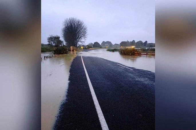
People in the Eastern Bay of Plenty have been battered by a deluge, with rainfall of up to 230mm in 24 hours flooding roads, triggering slips and isolating towns.
Tāneatua and Rūātoki were inaccessible by road on Wednesday morning.
Awakeri resident Raewyn Chapman is isolated with no way to get out from her house.
Water has completely flooded her property and surrounded the house, she says.
Stock have had to be moved from flooded paddocks to the only piece of dry land left in the hay barn.
Whakatāne resident Mike Geddes spoke to residents at Valley Road who described a loud violent noise of rocks grinding in the early hours of the morning.
"It took out some power lines and is covering the road. Fortunately it missed the houses, but it was frightening for them - there is a house right at the top of the slip too."
Whakatāne River is on its second warning levels and is continuing to rise, says a spokesperson for Bay of Plenty Regional Council, which was working with Civil Defence and local councils to monitor the developing situation.
'We are advising farmers with stock on low-lying areas adjacent to the Whakatāne and Tauranga Rivers to immediately move stock to higher ground.”
The Te Rahu spillway on the Whakatāne River near Awakeri is being used to relieve pressure from the lower parts of the Whakatāne River.
Water levels in the Te Rahu basin were predicted to continue rising over the next 12 hours and residents in nearby properties had been alerted by the council.
The Kaituna River level is just above the first warning level, but was also rising, and the regional council would text nearby landowners if it reached the second warning level.
The Matahina Dam was also continuing to spill throughout the day.
Slips and flooding are also affecting local roads. Wainui Road is down to one lane in places with temporary traffic management and Taneatua Road is closed, says transport agency Waka Kotahi.
The road is closed from the SH30/SH2 Awakeri intersection to the SH2/Wainui Road intersection until further notice.
Wainui Road could be closed at short notice if river levels rose significantly, and the road closure would be extended to Ōpōtiki, said a spokeperson for Waka Kotahi.
Geotechnical engineers are assessing the slips to ensure that it was safe to begin clearing the road.
There was also rockfall in the Waioeka Gorge which contractors were inspecting.
Residents in Rūātoki connected to the Whakatāne District Council water supply are advised to boil all drinking water for a minimum of three minutes due to flooding of water intake.
Whakatāne residents were asked to not flush toilets, limit shower use and let the dishes and washing pile up to conserve water as the system was overloaded with rain water.
MetService says heavy rain warnings will continue for Eastern Bay of Plenty, and had pre-warned about the possibility of rapidly rising rivers and streams, surface flooding and slips.
Taranaki and the west coast of the South Island, while heavy rain watches were also in place for Northland, Tongariro National Park, Tasman and Buller.


0 comments
Leave a Comment
You must be logged in to make a comment.