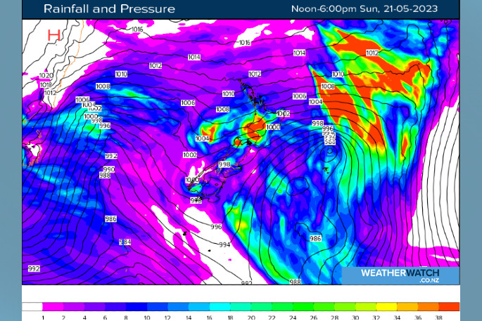
Our latest low pressure system that's brought more rain to many regions is spinning eastwards away from New Zealand today, leaving a strong cool west to southwest flow in its wake, says WeatherWatch.
The gusty remnants of the recent turbulent system will predominantly be felt across much of the North Island, while conditions are set to be generally more settled in the South Island.
Partly cloudy skies, strong westerlies and the odd passing shower is likely to be the theme of the day across northern regions, from Northland down to Bay of Plenty including Auckland, Waikato and Coromandel.
Further south, more frequent showers can be expected about Taranaki and Manawatu, particularly in the morning and early afternoon.
They'll be accompanied by that strong westerly wind, gusting 90kph in exposed places.
It's a similar story about Wellington and Wairarapa, with fresh southwesterlies, mostly cloudy skies and a few showers expected, particularly earlier in the day.

Winds swing to a light northerly about Wellington in the evening.
Morning cloud clears off about the east coast, including Hawke's Bay, resulting in a mostly sunny afternoon with fresh westerly breezes.
Temperature highs will be on the cool side right across the North Island, with most regions set for highs in the mid-teens, and just 10-12 degrees about central, inland regions.
South Island
In the South Island, a mix of sun and cloud can be expected in the Tasman, Nelson, and Marlborough districts after overcast skies break up during the morning.
A few showers turn to periods of rain for the West Coast, north of around Hokitika with fresh southwest breezes.
It'll be a showery start to the day with gusty southerlies along the east coast, including for the likes of Christchurch before conditions ease up during the morning and cloud breaks up in the afternoon.
Wind gusts of up to 80kph are likely about exposed places on Banks Peninsula at first. The day will become fine in the afternoon for the southern regions, after a cloudy, cold morning for most. Some frost in sheltered places is possible.
Parts of inland Southland, Otago and the Mackenzie country will remain particularly cool, with daily highs likely to remain in the single digits.


0 comments
Leave a Comment
You must be logged in to make a comment.