For the first King's Birthday weekend in over 70 years and the first weekend of meteorological winter, MetService is advising holidaymakers to keep up to date with local forecasts and road conditions.
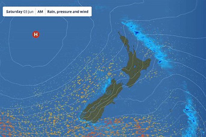
Rain will be the dominant feature for both Islands, with snow also expected in the south. Saturday will however be the best day of the long weekend.
'Saturday looks to be the best day of the long weekend, but any plans for Sunday onwards should include a raincoat, an umbrella, and a check of highway conditions – regardless of your location,” says MetService meteorologist Clare O'Connor.
In the lead up to the weekend, a front travels northwards up the country, bringing plenty of weather with it.
Severe Weather Watches and Warnings for Heavy Rain are in place for the West Coast of the South Island, Fiordland and the headwaters of Canterbury and Otago through to the early hours of Friday.
Thunderstorms are also expected in the West Coast region and Fiordland this afternoon (Thursday) and evening.
Road Snowfall Warnings had been issued for the South Island's alpine passes overnight Thursday.
'No doubt this snow is good news for South Island ski fields with opening weekends fast approaching.”
The North Island doesn't escape the weather on Friday with showery and rainy weather expected, mostly as the front moves through.
Strong Wind Watches are also in place across eastern South Island regions and the lower North Island south of Featherston Thursday into early Friday.
Although roads should be clear in time for people heading away for the long weekend, the return journey may not offer the same experience.
Another front arrives on Sunday with more wet weather affecting both the North and South Islands, with the possibility of heavy rain for some South Island areas.
MetService's Severe Weather Outlook also indicates a second period of snowfall on Sunday for South Canterbury and inland Otago, with a possibility of snow to lower levels as wintry weather kicks in.
While any necessary road snowfall warnings will be issued by MetService over the weekend, other road conditions can be found from Waka Kotahi's Journey Planner.
This wet start to June is in line with a wetter than usual outlook for many regions, as was the case for May. For example, a phenomenal 618.2 millimetres was recorded at the weather station at Hokitika Airport in May, which was the third wettest month on record there since records began in 1963. Many monthly rainfall records were broken across the country during May – see MetService's Rural Outlook for more details.
 Image: MetService.


0 comments
Leave a Comment
You must be logged in to make a comment.