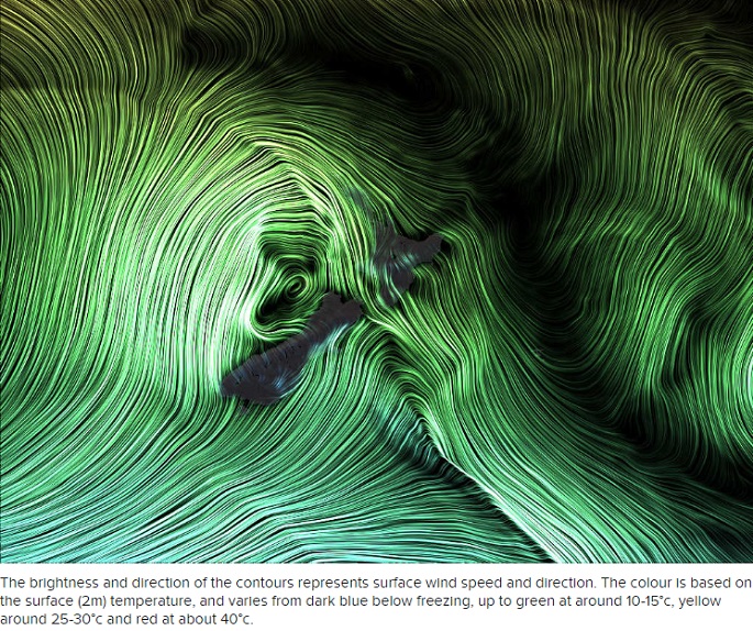
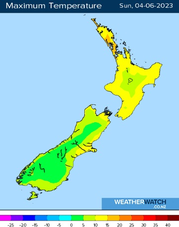
Those in the South Island will be gazing at the recent warmer temperatures in the rear-view mirror today as a cold front sweeps north, bringing plummeting temperatures and heavy snow to the high-country, says a WeatherWatch spokesperson.
In contrast, it will be a mainly fine day across much of the North Island, barring developing showers in the west and about Wellington, before the front makes itself known to most regions late in the evening.
Starting off in the Deep South, where the cold front first makes landfall - expect squally rain with fresh, chilly southerlies to develop across Southland and Otago with some heavy falls at first and possible hail about the south coast.
Inland snow may lower to around 400-500 meters during the morning.
Rain eases back to isolated showers across the region in the afternoon but those temperatures remain cold with highs only staggering to 7 degrees for the likes of Invercargill and Dunedin, and 4-5 degrees across Central Otago.

High cloud with fresh, gusty northerlies at first about the Mackenzie district and South/Mid Canterbury, turns to cold southerlies during the morning before hitting Christchurch and North Canterbury during the early afternoon.
Expect squally rain with the arrival of the front, quickly turning to periods of heavy snow to lake level across the Mackenzie district, where significant accumulations are likely.
Snow, heavy at times, is also expected to lower to around 400 meters about the Canterbury foothills with potentially significant accumulations above 500 meters.
Northerlies change southeast in the afternoon along the West Coast with periods of rain for most of the day. Expect a few showers across the Nelson/Marlborough region before turning to rain in the afternoon. Fresh northwest winds, changing southeast in the evening.
North Island
Northwest breezes and cloud increasing from the west looks to be the gist of the day with showers developing about Taranaki and Waikato, turning to rain in the evening.
Mostly dry with partly cloudy skies about Northland, Auckland and Bay of Plenty before the rain band moves in here too later in the evening.
Expect northwest winds to become strong and gusty about exposed places in the afternoon and evening.
Showers also develop about Wellington and Manawatu in the morning with those fresh nor'westers kicking in.
The pick of the weather for our Sunday is undoubtedly along the east coast of the North Island which remains protected from the approaching frontal system.
It'll be a mainly fine and sunny day there with just some high cloud and northwest breezes. Pleasant highs of around 17 degrees for Hawke's Bay.


.jpg)

0 comments
Leave a Comment
You must be logged in to make a comment.