Heavy rain is forecast for parts of the country, with heavy snow for parts of South Island and southeasterly gales for central New Zealand says MetService.
A front, preceded by a moist northwesterly flow, is moving over the south of the South Island from the southwest, with a low on the front to the west of the South Island.
The front and low move northeast over central and northern New Zealand from Sunday afternoon to early Monday. These features bring a period of rain to most places.
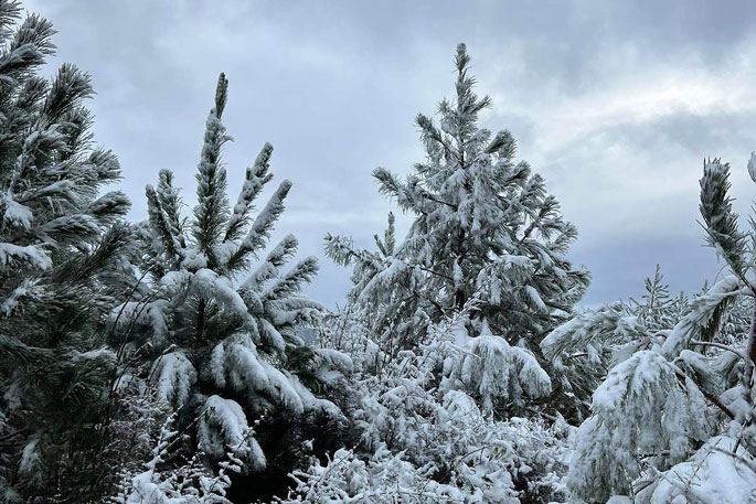
Much colder southerly winds follow the front, which should bring the snow level down to around 400 to 500 metres in Canterbury, Otago, Southland and Fiordland.
It's likely that several of the higher South Island roads will be affected by snow, and high country farmers in Otago and Canterbury are advised to prepare for the potential of significant snowfall.
People are advised to keep up to date with the latest forecasts in case any changes are made, or further areas are added.
Heavy Snow Warning
Heavy snow may disrupt travel in affected areas and could damage trees and powerlines. Cold conditions may cause stress for livestock.
Area: The Mackenzie District
Valid: 9 hours from 12:00pm Sun 4 Jun to 9:00pm Sun 4 Jun
Forecast: Expect 10 to 15 cm or more of snow above 600 metres, with lesser amounts down to 400 to 500 metres.
Heavy Snow Watch
Area: Central Otago about and west of Alexandra including the Queenstown Lakes District
Valid: 5 hours from 9:00am Sun 4 Jun to 2:00pm Sun 4 Jun
Forecast: Snow is expected above 400 metres and snow amounts may approach short duration warning criteria, especially above 600 metres where the largest accumulations are expected.
Heavy Rain Watch
Area: Coromandel Peninsula
Valid: 24 hours from 6:00pm Mon 5 Jun to 6:00pm Tue 6 Jun
Forecast: Periods of heavy rain. Rainfall amounts may approach warning criteria.
Area: Gisborne
Valid: 27 hours from 6:00am Mon 5 Jun to 9:00am Tue 6 Jun
Forecast: Periods of heavy rain. Rainfall amounts may approach warning criteria, especially about the ranges. This Watch may be upgraded to a Warning closer to the time, and the validity period may also be extended.
Area: Hawkes Bay
Valid: 24 hours from 11:00am Mon 5 Jun to 11:00am Tue 6 Jun
Forecast: Periods of heavy rain. Rainfall amounts may approach warning criteria, especially about the ranges. This watch may be upgraded to a Warning closer to the time, and the validity period may also be extended.
Area: Canterbury north of Arthur's Pass and Marlborough east of Awatere Valley
Valid: 15 hours from 6:00pm Sun 4 Jun to 9:00am Mon 5 Jun
Forecast: Periods of heavy rain. Rainfall amounts may approach warning criteria, mainly about the ranges.
Area: Westland south of Otira
Valid: 9 hours from 9:00am Sun 4 Jun to 6:00pm Sun 4 Jun
Forecast: A period of heavy rain. Rainfall amounts may approach warning criteria, mainly about the ranges.
Strong Wind Watch
Area: Taranaki
Valid: 17 hours from 6:00pm Mon 5 Jun to 11:00am Tue 6 Jun
Forecast: South to southeast winds may approach severe gale in exposed places.
Area: Wellington and Marlborough Sounds
Valid: 15 hours from 8:00am Mon 5 Jun to 11:00pm Mon 5 Jun
Forecast: South to southeast winds may approach severe gale at times.
Area: Nelson, Buller and Marlborough west of Wairau Valley but excluding the Sounds
Valid: 13 hours from 10:00pm Sun 4 Jun to 11:00am Mon 5 Jun
Forecast: Southeast winds may approach severe gale in exposed places, mainly inland.
Area: Westland including the Grey District
Valid: 17 hours from 2:00pm Sun 4 Jun to 7:00am Mon 5 Jun
Forecast: Southeast winds may approach severe gale in exposed places, especially inland.
Watches no longer in Force
Heavy Rain Watch lifted for Fiordland: The threat of rainfall amounts reaching warning criteria has passed and the Watch is lifted.
Heavy Snow Watch lifted for Canterbury High Country about and north of Rangitata River: Heavy snow is no longer expected down to 500 metres and the Watch is lifted. However, note that heavy snow is still possible at higher elevations.


0 comments
Leave a Comment
You must be logged in to make a comment.