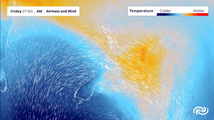
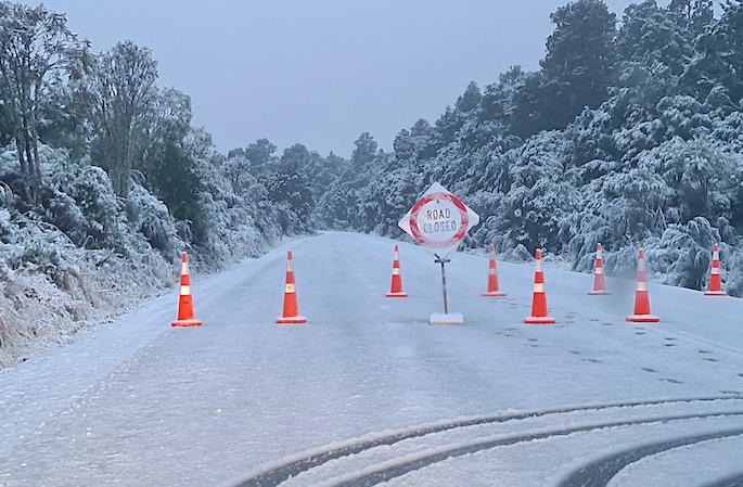
MetService is forecasting a week of contrasting weather, with warm temperatures mid-week giving way to a chilly blast that is expected to bring unseasonable cold and snow to low levels on Friday for the South Island.
This all plays out while Severe Tropical Cyclone (TC) Lola in the western Pacific tracks towards Vanuatu, with MetService meteorologists keeping a keen eye on what it might mean for Aotearoa New Zealand at the end of the weekend into next week.
The working week kicks off with a strong, moist northwesterly flow that brings wet weather for the western South Island, Tararua Range and Taranaki Maunga, as well as strong winds for central Aotearoa New Zealand.
“Heavy Rain and Strong Wind Watches have been issued to cover many areas in the South Island, lower North Island and Mount Taranaki into Wednesday morning. This weather system is a bit of a taster of what’s to come later this week,” says MetService meteorologist Mmathapelo Makgabutlane.
“Temperatures rise to the mid to upper-20s on Wednesday and Thursday for the eastern stretch of the country. Christchurch, Kaikōura, Napier and Hastings could see some of their warmest temperatures this spring on Thursday."
The truly changeable nature of spring is on full display from Thursday to Friday, as the next approaching weather system comes through with a contrasting cold blast.
“It will feel like someone has turned the dial back to winter mode. Dunedin, for example, goes from a warm 21°C maximum on Thursday to just an 8°C high on Friday – a very noticeable change!”
The bitterly cold southwesterly flow also brings showers of snow to much of the South Island on Friday, even falling near sea level in Southland and coastal Otago, including Clutha.
“This may have an impact on livestock and farmers are encouraged to take advantage of the next few days to prepare accordingly. Travel may also be impacted on Friday as widespread snow showers are expected across the South Island.”
In addition to the icy blast, the weather system brings a dousing of heavy rain to the western South Island and strong winds for much of the South Island and lower North Island on Thursday and Friday.
Meanwhile, Vanuatu and the western Pacific are bracing for Severe Tropical Cyclone Lola, which as of Tuesday morning was a Category 5, making it the most intense tropical cyclone to form ahead of the official start of the season (1 November to 30 April) in recorded history.
Thoughts are with our neighbours in the Pacific.
Signals at the moment are that the system will weaken as it heads south but is likely to interact with another system forming in the Tasman Sea.
“There is still plenty of time to clarify where and what impacts the remains of Lola will have on Aotearoa New Zealand. Early indications are that into early next week the northern parts of the country are most likely to see wetter weather and strong winds, while high pressure builds across the southern parts of New Zealand.
“The MetService forecasting team will continue to monitor the situation in the Tropics. The best advice is to stay up to date with the latest MetService forecasts and any Watches and Warnings issued.”
Severe TC Lola will be bringing strong winds, heavy rain and damaging swell to Vanuatu and New Caledonia, and people in these areas are advised to keep up with any Warnings issued by the local meteorological centres and emergency services.
While Severe TC Lola remains in the Tropics, Fiji Meteorological Service will be producing the warnings and track maps, which are available on their website.
 Image: MetService.


0 comments
Leave a Comment
You must be logged in to make a comment.