A 30 year plan for the future of the Mount Maunganui to Arataki area sets out how Tauranga City Council will protect and enhance existing community values, as well as respond to future opportunities and challenges.
On Monday, Council adopted the Mount to Arataki Spatial Plan - Te Mahere ā-Takiwā o Mauao ki Arataki, which sets out a plan that respects where we’ve come from and what we love about the area, while also focusing on the community’s needs.
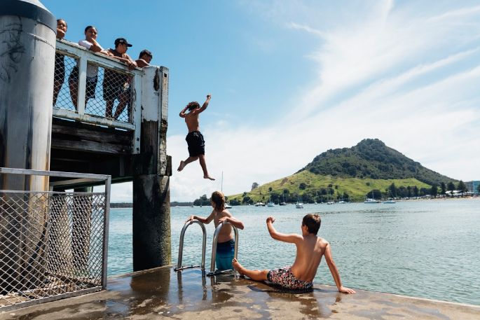
The Mount to Arataki area is home to 16 per cent of Tauranga’s population and includes the communities of Mount Maunganui, Omanu, Arataki and Whareroa.
The coastal strip is expected to see ongoing residential growth due to intensification around established community centres; the lifestyle; and proximity to beach and open spaces, commercial and retail centres and the economic and employment hub of the industrial area.
The spatial plan provides direction on the actions and investments necessary to support the area’s anticipated growth.
In 2023, Council asked community members what they love about the Mount to Arataki area, and what matters to them most, so that we could plan a future that protects the things we love, enhances the things we already have, and makes room for the things we want.
With this input, we created a draft plan and sought further feedback on key projects and ideas using an online tool with interactive maps.
Commission chair, Anne Tolley says feedback from the community, mana whenua, schools, businesses, and other interest groups was vital in developing a thirty-year vision for the area.
“We really appreciate the input we’ve received from all corners of the community throughout this process,” says Anne.
“Through two rounds of public engagement and numerous workshops, hui, and community events, we received over 10,000 individual pieces of feedback and we’ve used that input to create a plan that will support liveable, unique, connected and healthy neighbourhoods.”
Liveable neighbourhoods will allow us to reside close to the places that meet our daily needs, such as workplaces, schools and shops, and provide for a greater range of housing types.
Growth will continue to place pressure on the Mount to Arataki area’s transport network, and connected neighbourhoods will mean we can move around and get to the places we need to go easily by using a range of travel options, including improved and safer facilities for cycling and walking, and better access to the beach.
Healthy neighbourhoods require a healthy environment and will allow us to connect with others and the outdoors, increase biodiversity, enhance water and air quality, and minimise effects from industry.
Input from the Mount Industrial Study has been incorporated to better manage the relationship between the Port of Tauranga and local industries with the neighbouring communities.
A healthy neighbourhood will also be resilient to climate change and natural hazards.
The Mount to Arataki area will reflect our city’s unique culture, history and people. Neighbourhoods will have an enhanced sense of place which reflects our local identity.
Areas of significance to tangata whenua will be protected, enhanced, commemorated and celebrated, in turn enriching the culture and identity of the wider community for generations to come.
Implementation of many of the spatial plan’s actions has already commenced, or will commence shortly, and will be supported by the adoption of the spatial plan and Council’s 2024-34 Long-term Plan.
This includes enhancing air quality in the industrial area and improving the area's parks and sports fields.
For more on the Mount to Arataki Spatial Plan and to read the full plan, please visit https://letstalk.tauranga.govt.nz/projects/mount-to-arataki-spatial-plan.

3 comments
"Managing traffic congestion"
Posted on 27-03-2024 07:53 | By jed
Council has directly caused traffic congestion along Maunganui road, by narrowing the road, blocking right hand turns, and 'traffic' calming measures such as raised pedestrian crossings, permanent road cones etc.
The plan is just a joke when councils says they want to avoid congestion but are the ones causing it.
There's that word again
Posted on 27-03-2024 12:50 | By nerak
spatial. Gets a lot of use from the kids at council these days. It's origin is Latin, and it's been around since the mid 19th century, so the kids have been slow to pick it up, but are now at risk of over using it. One explanation of the word: Spatial describes how objects fit together in space, either among the planets or down here on earth. There's a spatial relationship between Mars and Venus, as well as between the rose bushes in the backyard. Personally, I like the Mars/Venus bit, it fits well with my opinion of the origin of the kids who dream and scheme.
Congestion ?
Posted on 27-03-2024 22:30 | By Naysay
Concerned now ? Wait until they adopt plan change 33. The entire Mount will be in steroids. We can't cope now :)
Leave a Comment
You must be logged in to make a comment.