Update 3pm
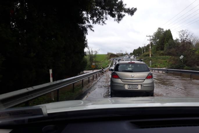
Crews have now closed State Highway 2 at Nuhaka following surface flooding in the area.
Heavy and persistent rainfall in the area has meant that the state highway has closed 2 kilometres south of the township.
It will remain closed until further notice.
Please avoid the area if possible and if travelling on other parts of the network, expect delays.
Meanwhile,
State Highway 2 north of Gisborne and State Highway 35 both remain open.
Crews in Tairāwhiti will continue to monitor the state highway network around the region this afternoon and overnight, following heavy rainfall today.
NZTA is advising road users to drive to the conditions around the region, be prepared for delays and expect higher-than-usual water levels in some areas.
A Metservice heavy rain watch in place for Tairāwhiti is expected to lift later this afternoon.
Please keep up to date by visiting NZTA’s Journey Planner in the event of any short notice closures needed.
Update 12.15pm
State Highway 35 (SH35) between Te Puia township and Tokomaru Bay has now reopened.
The stretch of road was closed just before 10.30 today following heavy and persistent rainfall, causing surface flooding and rising river levels.
The road has now reopened and crews are continuing to assess the network for any signs of flooding or safety risks.
NZTA is advising road users to avoid travel if possible and drive to the conditions on the state highway network around the region.
NZTA will provide an update at 3pm.
Please also keep up to date by visiting NZTA’s Journey Planner in the event of any short notice closures needed.
10.30am
State Highway 35 (SH35) between Te Puia township and Tokomaru Bay has been closed, due to surface flooding.
The stretch of road was closed just before 10.30 today following heavy and persistent rainfall, causing surface flooding and rising river levels.
The road will remain closed until further notice.
Metservice is warning of further rainfall in the area during the day.
NZ Transport Agency Waka Kotahi System Manager Martin Colditz says the decision has been taken to close the road for the safety of all motorists and the local community.
NZTA is advising road users to avoid travel if possible and drive to the conditions on other parts of the network.
Crews are regularly assessing other parts of the network for any signs of flooding or safety risks.
Please keep up to date by visiting NZTA’s Journey Planner.
Plan ahead for a safe, enjoyable journey. Keep up to date with:
- Traffic updates: journeys.nzta.govt.nz/traffic
- Facebook: https://www.facebook.com/nztahbg
- X (formerly Twitter): https://www.twitter.com/nztacni
- Journey planner: journeys.nzta.govt.nz
- Phone: 0800 4 HIGHWAYS (0800 44 44 49)


0 comments
Leave a Comment
You must be logged in to make a comment.