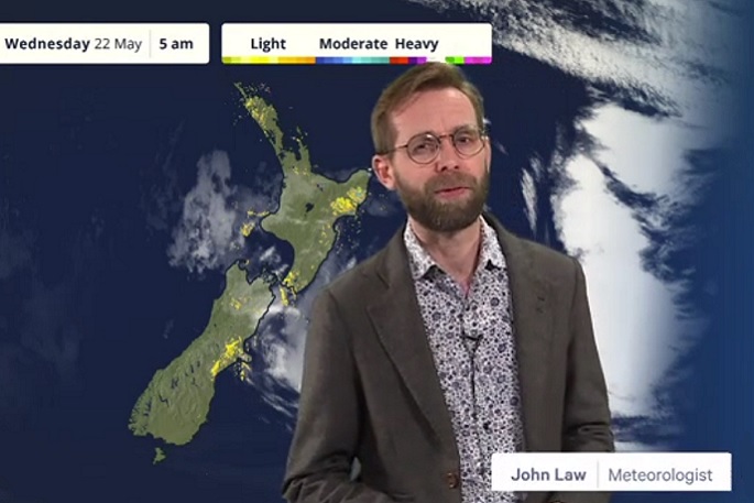
Rain continues to feed into the east of the North Island of New Zealand today.
MetService says a Severe Weather Warning remains in place for the northern parts of Hawke's Bay, north of the Napier- Taupō road/State Highway 5 into Thursday.
Severe Weather Watches have also been issued for the rest of Hawke's Bay, the Tararua District and Tairāwhiti.
The rain remains on the East Coast for Thursday, but with some drier and brighter weather further to the west.
For the South Island, It'll be a cold start to Thursday for Southland and Otago with temperatures set to be below freezing first thing, but with any early fog clearing to leave a fine morning before the cloud arrives ahead of the next band of rain moving in from the south.
The weekend sees the return of southwesterly winds sweeping up the country.
These warnings cover the next 24 hours please check metservice.com/warnings/severe-weather-warnings for the latest information.
Friday, May 24 2024
A showery south to southwest flow covers the northern and eastern North Island on Friday, while a couple of cold fronts move onto the South Island.
There is low confidence that rainfall amounts could reach warning criteria about the Wairoa District, mainly during the morning.
Saturday, May 25 2024
A strengthening southwest flow spreads over New Zealand on Saturday.
There is moderate confidence that southwesterly winds could rise to severe gale about exposed parts of coastal Dunedin, Clutha and Southland from about Invercargill eastwards, and low confidence of severe southwest gales about other parts of southern Southland (including Stewart Island) and eastern Otago.
Sunday, May 26 2024
A strong cold west to southwest flow covers New Zealand on Sunday, but this should ease later in the day. Snow is possible to low levels about the southern South Island.
There is moderate confidence of severe southwest gales about exposed parts of coastal Clutha and Dunedin (mainly during the morning), and low confidence about Banks Peninsula and other parts of eastern Otago, inland Clutha and eastern Southland.
There is also low confidence that southwesterlies could reach severe gale about exposed parts of Nelson/Tasman, and low confidence that westerly winds could reach severe gale about exposed parts of Hawke's Bay and Tararua District.
Monday, May 27 2024
The southwesterly flow covering the country eases on Monday, however there is low confidence that southwesterlies could approach severe gale about coastal parts of Dunedin, Clutha and eastern Southland (mainly during the morning).


0 comments
Leave a Comment
You must be logged in to make a comment.