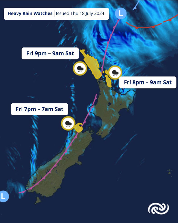
Possible heavy rain for eastern and northern parts of the North Island is being forecast on Friday and Saturday as a low pressure system brushes past east of the country.
This continues the mixed bag of weather that has characterised this past week.
A rapidly developing low pressure system is expected to pass east of the country on Friday and Saturday, bringing wet weather to many parts of the North and South Islands.
Watches for Heavy Rain have been issued for Northland, northern Auckland, the Coromandel Peninsula, and west Tasman.
"The extent and intensity of rainfall will depend on the low's eastward or westward movement. This means that additional areas may be added to these Watch areas in the coming days," says MetService meteorologist Mmathapelo Makgabutlane.
"It’s a good idea to keep a close eye on the forecast, especially as holidaymakers head home at the end of the school holidays."
The weather is expected to ease by Saturday evening as the low pressure system moves away, bringing a break in the weather to start Sunday.
However, the next weather system is never too far away.
By Sunday afternoon, another system is expected to make its way across the country, bringing rain and showers to the North Island and western South Island, along with brisk winds to the top of the country.
This pattern continues into Monday, so a rain jacket may be needed for the back-to-school commute.
After a few foggy days this week, many might wonder if more are in store.
"Chances of widespread fog in the North Island similar to what we’ve seen this week are reduced over the weekend. However, some spots in the South Island could still see fog at times this weekend and possibly into next week."
 Image: MetService.


0 comments
Leave a Comment
You must be logged in to make a comment.