A forecaster is warning Kiwis to “rug up warm tonight” with temperatures set to plummet near or below freezing for much of the country.
MetService meteorologist Dan Corrigan says the country’s current showery weather would give way to “mostly clear skies” as last weekend’s low-pressure system moves away to the east.
“This will happen tonight for the South Island and then tomorrow morning for the lower and central North Island,” Dan says.
But the clear skies are accompanied by drops in temperature, with MetService forecasting Twizel to plummet to -5C overnight. Timaru was also expected to plunge to -2C, despite being a coastal city.
Brrr, make sure to rug up warm tonight, especially down south!
— MetService (@MetService) July 22, 2024
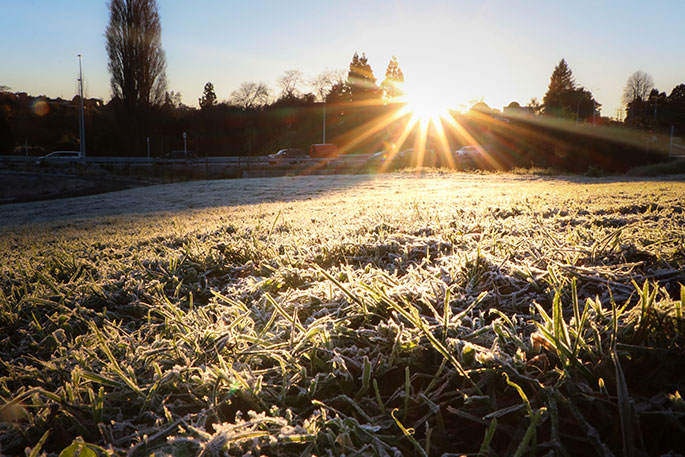
Clearing skies and incoming cool air mean widespread frosts are forecast across the lower and central South Island, and for some sheltered parts of the central North Island as well.
Twizel is forecast to… pic.twitter.com/H4jjiZ0k8Q
Queenstown and Wanaka have also been tipped to start the day below freezing at -2C.
“Expect widespread frosts in the South Island on Tuesday and Wednesday, also about sheltered inland parts of the North Island,” Dan says.'
Meanwhile, Dan says Northland, Auckland and Waikato would remain showery until sunshine reappears on Wednesday and clear skies ensue. However, there was a small chance of a gusty thunderstorm before dawn on Wednesday.
Daytime maximum temperatures over the first half of the week were forecast in the low-to-mid teens, although sheltered parts of Central Otago would struggle to reach double digits until Wednesday, given the weaker sunshine at this time of year, MetService says.
Saying hi to high pressure!
It's been an unsettled couple of days for many, and Monday has a few more showers in store. But after that? Some sunshine just in time for kids to go back to school! pic.twitter.com/Z2Ygy1JMK3— NIWA Weather (@NiwaWeather) July 21, 2024
“Southwesterly winds in places that are more exposed to this direction, like Auckland, New Plymouth, Wellington, and Dunedin, may make it feel cooler than the temperature suggests,” Dan says.
A northwesterly wind flow from Thursday is forecast to boost daytime temperatures into the high teens, as well as reduce the chance of overnight frosts.
Meanwhile, MetService says a rapidly rising southwesterly swell is forecast to affect southern and western coasts of the South Island and west of the North Island on Wednesday.
“These waves will have a long period (time between each wave), meaning they will carry a lot of energy, making for hazardous coastal conditions.”
Orange road snowfall warnings have been put in place by MetService for Lewis Pass (SH7) and Porters Pass (SH73) this evening, with snow flurries expected about the summit of both roads.
Road Snowfall Warnings updated
— MetService (@MetService) July 21, 2024
Same as the previous issue, but the duration of both warnings has been extended by an extra hour
Snow flurries are expected about the summit of both roads where 1-2cm may accumulate.
Keep an eye on NZTA's journey planner for updates:… pic.twitter.com/d8kUZ59Weq
Dan says there was a risk of one 1cm to 2cm of snow accumulating.
“If you’re planning on travelling these roads tonight, make sure to check the Waka Kotahi NZTA Journey Planner for any updates. Drive to the conditions, accounting for reduced traction.”

0 comments
Leave a Comment
You must be logged in to make a comment.