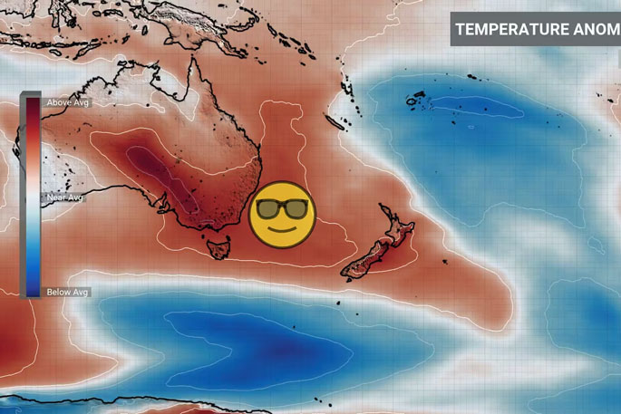
The winds of change are blowing over the country this week — heralding in warmer temperatures and giving Kiwis a small taste of spring.
MetService says fluctuating temperatures brought about by strong winds off the coast may be confusing as the week progresses.
MetService meteorologist Ngaire Wotherspoon wants people not to get used to the warmer temperatures because wet, cold mornings lie ahead at the end of the week.
Ngaire says the cold front that swept up the country yesterday has left us with a southwesterly flow that would taper off throughout the day.
She says a few showers will hit Northland and Gisborne today, but most places in the country will see clear skies.
The clear skies will make for warmer days, but frosty nights, says Ngaire.
“Sort of like Wednesday, Thursday, we are going to see temperatures getting into some of those like mid-to-late teens ... those will be quite sunny days.”
She warns Kiwis not to swap out raincoats for shorts just yet because rain is due to set in as the weekend begins.
Yesterday, a swath of severe weather alerts was issued nationwide, with forecasters warning those in the firing line to “batten down the hatches”.
MetService meteorologist Clare O’Connor says the weather is being driven by an intense cold front moving northwards, colloquially known as a “southern buster”.
“A southerly buster is a particularly strong cold front, characterised by blustery wind changes and a large drop in temperatures”.
Although the skies have cleared and wind has subsided, Clare says the wild weather will linger into today.
Heavy swells of up to 6m were expected for the east coast of the North Island and the Chathams. Tairāwhiti Civil Defence posted a wave warning, saying it was expected to cover Mahanga to Lottin Pt from 9am until 6am tomorrow.
Clare says the weather should begin to calm in other areas, with a high-pressure system expected to build over the country. Wednesday should start with below-average temperatures, particularly around the central North Island.
“The cold snap is short-lived with above-average temperatures expected from Wednesday afternoon as milder westerly winds develop about the lower half of the South Island, then spread northwards over Thursday.”
“Another swing to the lower end of the temperature scale, and a burst of heavy rain could be seen over the weekend.”


1 comment
Below average temperatures coming
Posted on 14-08-2024 07:30 | By Aah well
Refer last paragraph
Leave a Comment
You must be logged in to make a comment.