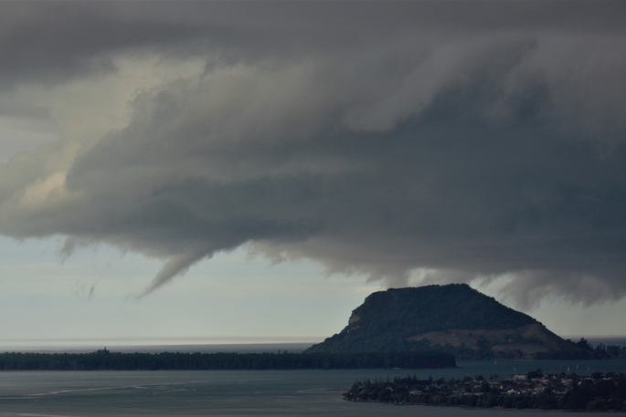
A severe thunderstorm watch is in place for central North Island today.
MetService said heavy showers were expected for Rotorua, inland Bay of Plenty, Waikato, northern Taranaki, Taupō and northern Taihape, with an “associated moderate risk of thunderstorms”.
The watch is in place between 2pm and 9pm.
The thunderstorms were expected to produce heavy rain with intensities of 10 to 25mm/h, and small hail, the agency said.
Severe Thunderstorm Watch Issued Over Central North Island for Friday
— MetService (@MetService) February 6, 2025
A Watch means that we have all the ingredients for thunderstorms and that these storms may become severe. We watch them as they develop.
A Warning is issued if a thunderstorm builds enough that it… pic.twitter.com/itbpoxFI8s
“There is also a moderate risk that some of these thunderstorms could become severe, producing localised downpours of 25 to 40mm/h.
“Rainfall of this intensity can cause surface and/or flash flooding, especially about low-lying areas such as streams, rivers or narrow valleys, and may also lead to slips.
“Driving conditions will also be hazardous with surface flooding and poor visibility in heavy rain.”
The weekend weather for Bay of Plenty, Rotorua and Waikato was mostly cloudy with possible afternoon showers both days.

0 comments
Leave a Comment
You must be logged in to make a comment.