A heavy rain warning remains in place for Tauranga this morning with New Zealand’s largest weather system of the year bringing heavy downpours.
Forecaster MetService warns that rainfall amounts may approach warning criteria as the widespread “atmospheric weather” bears down.
An orange heavy rain warning remains in effect for Northland – where peak rainfall amounts of 15 to 25mm/h were expected overnight and total amounts of up to 200mm before this afternoon.
“The heaviest rain is expected overnight in Northland and Friday morning around commute time for Auckland, extending to other areas throughout the day,” MetService meteorologist Mmathapelo Makgabutlane said yesterday.
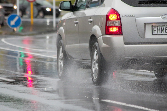
The forecaster warned that morning rain could lead to wet roads and slower traffic and advised commuters to allow extra travel time and drive to the conditions.
Meanwhile, a raft of other severe weather warnings and watches have been issued across the country from the top of the North Island to the South Island’s Westland District.
Heavy rain warnings are in place for the Coromandel Peninsula, Bay of Plenty, Gisborne, Tongariro National Park, Mt Taranaki and Tararua Range in the North Island throughout Friday.
Severe weather watches have also been issued for Waikato, Waitomo, Taumarunui, North Taranaki and Great Barrier Island.
Meanwhile, areas in the Tasman district recorded more than 100mm of rain between 12.01am and 1pm on Thursday. At the Paradise Peak weather station, 113mm had fallen, followed by 106mm at the Perry Saddle station.
“This could be a significant rain event for the Tasman districts,” MetService said earlier.
Forecaster Niwa said heavy rain would end on Friday morning for the South Island.
The Tasman District Council was warning residents that slips and flooding could affect vital roads.
“Isolated heavy bursts are possible and could result in more significant flooding in small creeks and surface flooding. Expect some slipping to occur in prone areas.
“Rainfall is forecast to be highest toward the end of the event when catchments are soaked.”
On the West Coast, State Highway 6 between Haast and Lake Moeraki was closed overnight due to forecast “severe weather conditions”. It was set to reopen at 8am today, subject to inspections.
The Grey District Council on the West Coast was providing sandbags to “anyone in need” on Thursday afternoon.
“If you’re concerned about flooding, please feel free to come by and pick them up. Stay safe and prepared,” a post on social media read.
MetService meteorologist Lewis Ferris told RNZ’s Checkpoint on Thursday afternoon that Hokitika had more rain in the prior 24 hours than it received during March.

0 comments
Leave a Comment
You must be logged in to make a comment.