
A busy stretch of weather is on the way, with many areas set to face a range of conditions throughout the week
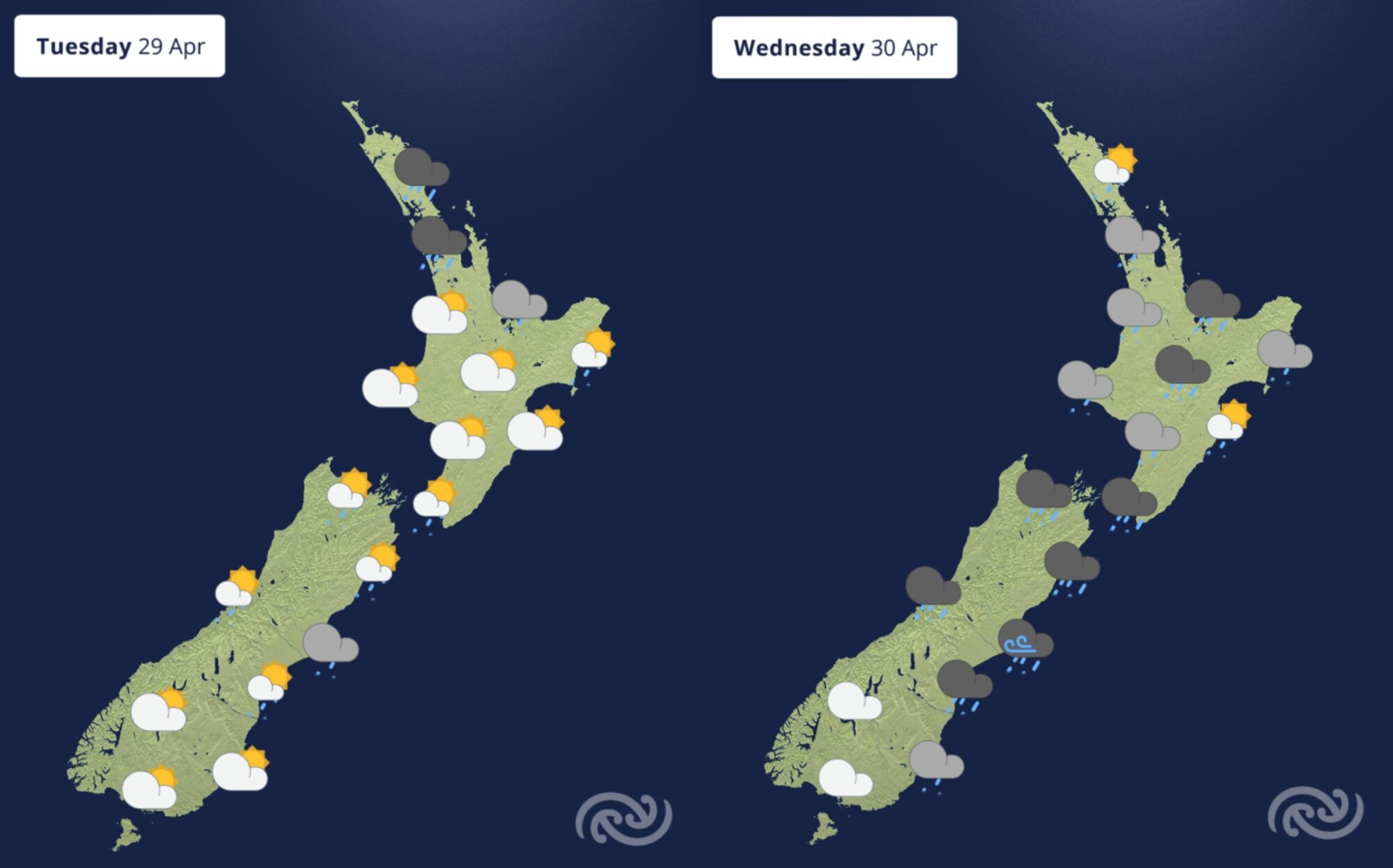
After an already wet month, Northland will see pockets of heavier rain on Tuesday, while Canterbury will see heavy rain from mid-week, said the MetService in its latest weather update.
Unseasonal snow is expected for inland Canterbury on Wednesday and Thursday.
Wild winds were expected for eastern and central parts of the country from Wednesday, with disruptive southerlies expected to surge through Wellington.
In the Bay of Plenty, heavy rain is forecast to ease tonight, with occasional rain forecast for tomorrow afternoon.
Rain is then expected to become persistent on Wednesday, before clearing on Thursday afternoon.
“Everyone is going to get a bit of something this week – there will be some sun, lots of rain and strong winds, and even some snow coming our way, as a low-pressure system passes right over central New Zealand,” said MetService meteorologist Dom Barry.
Come tomorrow, Northland, Auckland and the Coromandel can expect wet and windy conditions, with heavy rain and thunderstorms expected for the northern most regions.
Heavy rain will be hauled across much of the country heading into Wednesday by a low-pressure system which tracks across the central North Island.
Some of that rain will fall as snow above 600m in the South Island.
Thunderstorms are expected for parts of Northland into Thursday, which may bring periods of more intense rainfall to localised areas.
“For already sodden areas, particularly in the Far North, more heavy rain may bring impacts such as flash flooding, rivers to rise dangerously high and hazardous driving conditions,” said Barry.
“It is imperative people stay up to date with the latest forecasts and listen for any advice from local Civil Defence agencies.”
A heavy rain watch has been issued for Northland with a high likelihood of being upgraded to a warning, while the heavy rain and snow in the South Island has triggered a heavy rain watch for Canterbury.
“As we get closer to this event, more severe weather watches and warnings are expected to be issued, including road snow warnings, strong wind warnings and some more rain watches and warnings.
On Wednesday night and into Thursday, the low lingers east of Wairarapa, driving very strong and disruptive southerlies up Cook Strait and possibly into Wellington – these winds will be very strong, even for Wellingtonians’ standards.
Couple this with a very high tide (king tide), low pressure and heavy swell, and we could see coastal inundation in the south, said Barry.
“These very strong winds will be disruptive for travel in the Wellington and Marlborough regions on Wednesday evening and into Thursday. It won’t be a day to cycle to work – work from home or take the bus.“
Strong winds will also affect Canterbury into Thursday, while strong winds will be felt west of the main divide at times.
Choppy seas up the east coasts of both islands and possibly into Wellington can be expected from Wednesday, with possibly up to 7m of combined waves off the east coast of the North Island.
Temperatures remain warmer than average overnight for many places though to Wednesday, before things cool off come Thursday.
The minimum temperatures for places like Masterton, New Plymouth, Wellington and Wānaka become their maximum temperatures from Thursday – a noticeable difference.
It is quite a wild weather week ahead – stay up to date with the MetService app or at www.metservice.com
Periods of heavy rain is expected on Wednesday. Photo / MetService

0 comments
Leave a Comment
You must be logged in to make a comment.