A settled start to the school holidays will be short lived with heavy rain forecast for Bay of Plenty later this week.
MetService has issued an orange heavy rain warning for the region for areas west of Whakatāne at 8am on Thursday.
Up to 120mm of rain could fall until 3am Friday.
#VIDEO: Another big low late week brings severe weather risks to #NewZealand https://t.co/aQAELrp8E8 via @YouTube
— WeatherWatch.co.nz (@WeatherWatchNZ) June 30, 2025
Areas east of Whakatāne can expect up to 180mm of rain for 12 hours from 12pm Thursday.
The rain is driven by a front moving southeast from the Tasman Sea over northern and central New Zealand which will also bring strong northeasterly winds.
Thunderstorms are also possible in the north.
A heavy rain watch is in place for Coromandel, Auckland and Northland with a moderate risk that north or northeasterly winds will reach severe gale in exposed parts of these areas.
The low should move on to the North Island during Saturday, with further bands of rain, showers and possible thunderstorms over northern and central New Zealand.
There is low confidence that periods of rain about eastern Bay of Plenty, Tasman/Nelson and northern Marlborough may require a heavy rain warning.
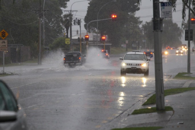
The region received significant rainfall last Friday with surface flooding reported in Rotorua and Tauranga.

0 comments
Leave a Comment
You must be logged in to make a comment.