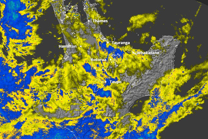
Heavy rain warnings have been issued for Bay of Plenty from late morning as a new “atmospheric river” moves down from the subtropics.
A severe thunderstorm watch is also in place for the region tonight.
MetService meteorologist Devlin Lynden said they were keeping a close eye on Bay of Plenty.
He said the region acted like a “scoop” for wild weather especially as the northeasterlies pushed the rain there throughout the morning.
“So we’re expecting some quite large accumulations for the Bay of Plenty area, between 90 to 120mm/h for the broader Bay of Plenty area.
“And looking into the eastern ranges there, we’re expecting between 150 to 200mm to accumulate through the day and into the early hours of tomorrow morning.”
Lynden said the most “interesting” element of this weather system so far has been the wind.
“[The wind is] gradually spreading down the rest of the North Island through today. It’ll be windy all the way along that kind of eastern coast there.
An orange heavy rain warning is in place for the Bay of Plenty areas west of Whakatāne from 10am today to 3am tomorrow and east of Whakatāne from noon until 10am Friday.
The thunderstorm watch is in place between 7pm and midnight.
Bay of Plenty Civil Defence warns to get indoors immediately if you hear distant thunder or see a flash of light.
“If you are in a car, stay in the vehicle with your windows closed. You are safer from lightning in a vehicle than out in the open.”
Meanwhile, a spokesperson for Air New Zealand said so far, there were no weather-related disruptions to flights.
However, they said they were monitoring the situation closely.
Bay of Plenty Regional Council duty civil defence controller Stace Tahere said it had not been long since the last heavy rain, so the ground may still be sodden.
People were encouraged to clear their drains and gutters, and be aware of potential surface flooding, slips and difficult driving conditions.
“If there is surface flooding in your area and you see rising water, do not wait for official warnings. Head for higher ground.”
The Bay of Plenty Regional Council Flood Room has been shifted to an active watch status as a precaution.
A duty flood manager said water would be spilled from the Matahina Dam due to significant recent rain in the Rangitāiki catchment, and stock on low-lying ground beside the Rangitāiki River should be moved higher.
“This warning does not apply to areas protected by stopbanks … there is no risk of flooding in Edgecumbe or the Rangitāiki Plains area.”
Rotorua Lakes Council said there was potential for surface flooding and rising waterways and encouraged residents to clear drains and gutters and drive cautiously, especially in low-lying areas.
 Flooding along Welcome Bay Rd last Friday.
The planned closure of the State Highway 2 Pekatahi Bridge today for deck repair work has been postponed until Friday, weather permitting, NZ Transport Agency said.
People may want to do outdoor activities with their children during the school holidays, but “I would avoid that for much of the country, upper South Island, much of the North Island”, Brandolino said.
“I would avoid Thursday certainly, I would avoid Friday and I might even avoid Saturday.”
The resurfacing work will now take place on Monday.
Earth Sciences New Zealand meteorologist Chris Brandolino said an atmospheric river that stretched up to sub-tropical New Caledonia would sweep over much of the North Island and the top of the South Island in the coming days.


0 comments
Leave a Comment
You must be logged in to make a comment.