MetService advise that a complex weather system continues to affect the country, before moving away to the south late Saturday.
Further heavy rain and possible severe thunderstorms are expected to affect already saturated areas of the North Island, while the South Island experiences another chilly day.
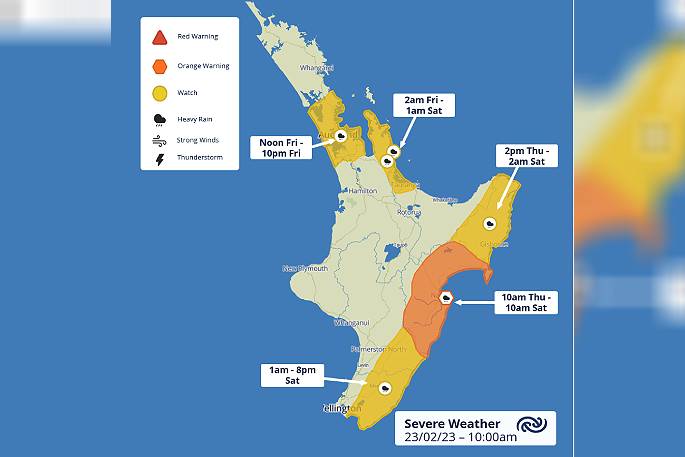
An Orange Warning for Heavy Rain has been issued for the Hawke's Bay region with grave concerns for impacts given the already vulnerable terrain.
From now until Saturday morning, areas in the region can expect 150 to 200mm of rain to fall. The heaviest falls are likely from 3pm Friday, with peak rates of 20 to 30mm/h possible.
'MetService are concerned for vulnerable areas like Esk Valley and the Wairoa District, given that 150 to 200mm in those areas could have significant impacts given slash and slit through the area,” says
MetService meteorologist Amy Rossiter.
Heavy Rain Watches area also in force for Gisborne, Wairarapa (including the Tararua District), along with Auckland, Coromandel Peninsula and Western Bay of Plenty.
'Additional heavy rain in these already saturated regions will be significant, and further flooding and slips may occur. We continue to brief those emergency services and lifelines working in recovery in the affected regions.”
There is also a risk of thunderstorms for much of the upper North Island today and tomorrow, with the potential that some of these thunderstorms could be severe.
MetService has issued Severe Thunderstorm Watches for this afternoon for Auckland, the Coromandel Peninsula, the Hauraki Plains and Bay of Plenty from Te Puke westwards.
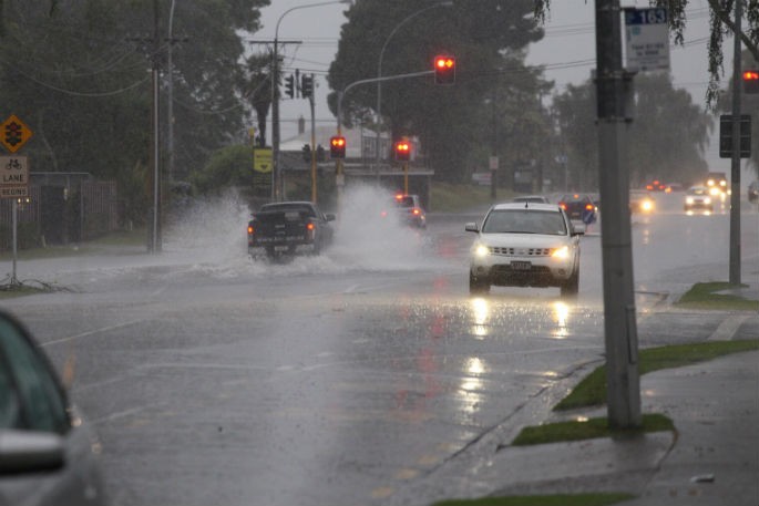
Downpours associated with these thunderstorms could reach peak intensities of up to 40 mm per hour. Rainfall of this intensity can cause surface or flash flooding and may also lead to slips.
'People in these areas are advised to prepare as best they can in case of a downpour, although localised 40mm in an hour is a large amount of rain,” Amy advises.
As this system moved northwards over the country it brought unseasonably cold air, and we saw a sharp change in temperatures that would have you pulling out the winter coats.
'Alexandra, in Central Otago, had a high of 28.4°C on Tuesday but yesterday only managed to reach 12.3°C. We even saw snow flurries as low as 1200m through Otago and Canterbury.”
The below average temperatures are expected to slowly climb back to normal values through the weekend.
Further afield, eyes are on the Tropics for any potential tropical cyclone development. MetService has a dedicated Tropical Cyclone Bench who are monitoring a potential system that may develop mid next week.
At this stage, it is too early to tell if this system will have any effect on our weather. Stay up to date with MetService.com as we release any new information.
 Image: MetService.


0 comments
Leave a Comment
You must be logged in to make a comment.