A large low this week, a cold front this Saturday - it's hard to believe high pressure is currently surrounding New Zealand.
As the highs continue to avoid being centred over us (bringing drier weather) NZ remains in an unsettled weather pattern, says WeatherWatch.co.nz.
Some regions are receiving less rain - but many are still getting daily (or regular) showers.
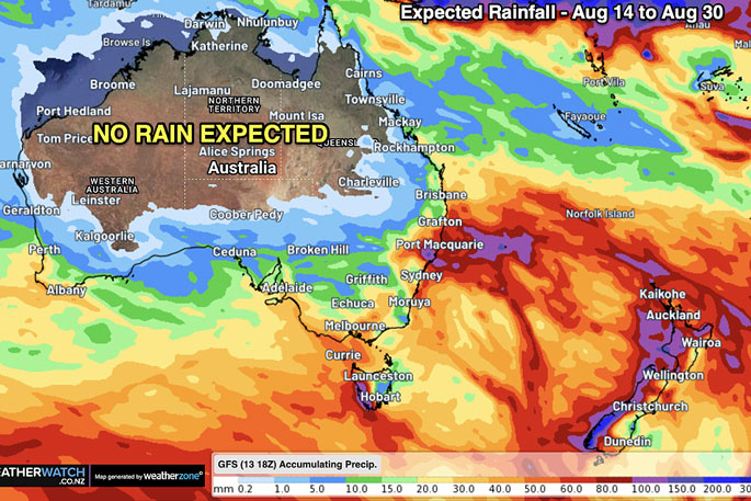
Australia's weather pattern over recent months has settled with more high pressure lingering for longer and wet weather mostly being pushed to the southern quarter of the nation - and lingering in some eastern coastal areas, says a spokesperson for the weather organisation.
"It's almost an El Niño weather pattern for Australia, but not 100 per cent there, especially with that rain still falling in the east between Sydney and Cairns.
"With no technical La Niña or El Niño at the moment in our part of the world we remain in a 'neutral' period - and that means more chaos.
"While it sounds like an oxymoron the neutral pattern means we don't have a dominant weather flow from any particular direction - so anything can happen. But Aussie's drying out phase coupled with NZ's increased westerly phase is a sign of a couple things: 1) Spring weather patterns often emerge by mid August in parts of Australia and northern NZ. 2) El Niño is continuing to develop and that also encourages an uptick in westerlies.
"But marine heatwaves around NZ and the western tropical Pacific are certainly complicating things - they aren't usually around during an El Niño phase."
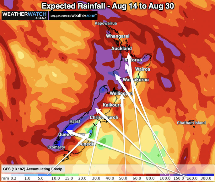
For the remainder of August in NZ it looks as though the bulk of the rain will be where it usually falls - in Fiordland and along the West Coast, says WeatherWatch.co.nz
"The western North Island is also seeing more rain and showers - but the further north and east you go the lower the totals will be, but for many it is certainly still too much. But this may be another sign of El Niño's weather pattern forming.
"NZ's location on earth means we're more exposed to many sudden weather changes, and our long range data from IBM suggests NZ will still see rainmakers and some chaos for the rest of 2023, especially from the south-west.
"But that data also shows northern and eastern parts of both islands gradually receiving lower rainfall totals each month ahead."
 Images: WeatherWatch.co.nz


0 comments
Leave a Comment
You must be logged in to make a comment.