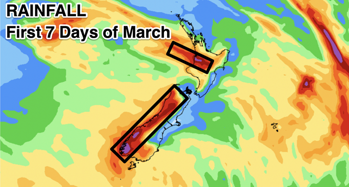
Despite a storm for New Zealand in the first week of March WeatherWatch.co.nz is expecting a drier than normal pattern to kick in for most regions as more high pressure continues to stream out of the Indian Ocean area, across southern Australia and over NZ.
El Niño + Autumn = a hat on a hat, says a WeatherWatch spokesperson.
"In other words, it can make autumn more autumn-like, with windier westerlies,warmer weather and more high pressure.
"However, our long range NZ data plus global data suggests that as El Niño fades, rainfall closer to normal will start to return into the NZ area."
In a nutshell, says WeatherWatch, March continues the dry, often summer like, weather despite an autumn storm around March 4 and 5, then as we go later through autumn New Zealand should see a return to more usual weather patterns and a heightened chance of rain makers.
"Of course long range forecasting for a mountainous island nation as small as ours in the Roaring Forties can be difficult - but the long range data we rely on most suggests autumn may have some late silver linings for those who need wet weather before winter arrives," says a WeatherWatch spokesperson.
"ClimateWatch is all about tracking monthly and longer term likely weather trends, based on the expected placement of high and low pressure zones.
"The natural chaotic nature of weather systems means the longer range you go with forecasts, the less reliable they can be... a bit like how high pressure water goes down a fire hose - it starts off straight then the further down the hose the water goes the more the hose snakes back and forth."

 Wet weather around March 2, 3, 4 and 5 will contribute to most of this wet weather, which mainly falls on Monday and Tuesday from a storm near the lower South Island. Map courtesy Weatherzone


0 comments
Leave a Comment
You must be logged in to make a comment.