MetService has issued a severe thunderstorm warning for parts of the Bay of Plenty and Waikato, including Western Bay of Plenty, Rotorua, South Waikato and Matamata-Piako.
The warning remains in effect until 4.30pm today.
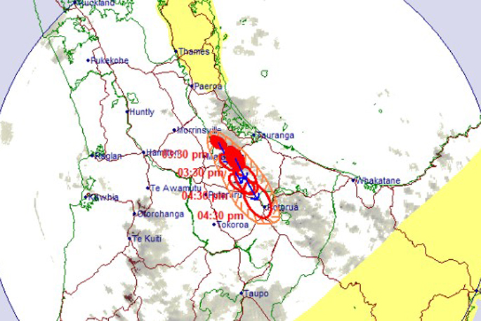
At 3.30pm, weather radar detected severe thunderstorms near southern and broader areas of the Kaimai Range, Pyes Pa and Oropi, MetService said.
Thesstorms are tracking south-southeast and are expected to impact Te Poi, the Mamaku Plateau, Mamaku, Pyes Pa, Oropi and Otanewainuku by 4pm, and Mamaku, Rotorua and Ngongotahā by 4.30pm, MetService said in its latest weather update.
“The thunderstorms are forecast to bring very heavy rain, which could lead to surface and flash flooding in streams, gullies, and urban areas, as well as hazardous driving conditions.”
A severe thunderstorm watch also remains in force for Coromandel Peninsula, Gisborne, Hawke’s Bay, Taihape and Whanganui.
The National Emergency Management Agency advises residents to:
- Take shelter indoors and stay away from windows
- Avoid sheltering under trees if outside
- Move vehicles under cover and secure loose objects
- Check drains and gutters to prevent blockages
- Exercise extreme caution when driving.
After the storms pass, people should watch out for fallen trees and power lines and avoid streams and drains due to the risk of flash flooding.

0 comments
Leave a Comment
You must be logged in to make a comment.