Sunny and dry conditions are being forecast for much of the country before rain and wind make a return this weekend.
After a chilly Thursday morning, the Metservice expects temperatures make a quick recovery over the coming days.
“This trend continues into Friday, but we’ll see wetter conditions developing over the western South Island later in the day – a precursor to the next weather system arriving early Saturday,” said MetService meteorologist Mmathapelo Makgabutlane.
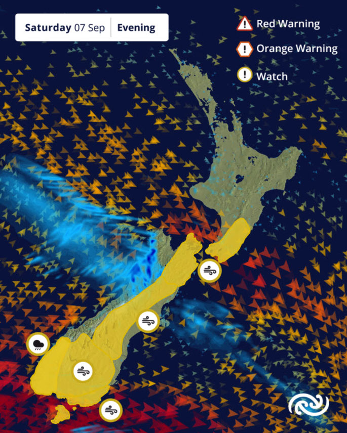
Westland wakes up to rain on Saturday morning, which could be heavy in the ranges.
The wet weather gradually spreads north through Grey, Buller, Tasman, and Nelson by the afternoon and evening.
On the eastern side of the Southern Alps, periods of rain are also expected, although not in the same intensity as the west.
For the North Island, the rain looks to move in late Saturday into Sunday, but is expected to clear quickly by the afternoon, with just a few lingering showers.
Beginning early Saturday, vigorous westerly to northwesterly winds will sweep over the South Island and lower North Island, with several Strong Wind Watches already in place.
The Canterbury High Country is expected to bear the brunt of the most intense winds. These winds are expected to ease by Sunday, although some areas may continue to experience breezy conditions.
After a chilly start to Thursday – the coldest morning felt in weeks – temperatures are set to rise rapidly.
By Saturday, eastern regions could even see mid-20s temperatures, driven by westerly winds ahead of the incoming weather system. Once it moves through, temperatures are expected to return to the seasonal September norm.
“If you’ve been feeling like the weather’s been on a bit of a rollercoaster lately, you’re not alone,” said Makgabutlane.
“Spring is a time of transition as the atmosphere shifts from winter to summer, and this year has already seen its fair share of ups and downs. It wouldn't be unexpected if this season has a few more swings in weather up its sleeve.”
 Image: MetService.


0 comments
Leave a Comment
You must be logged in to make a comment.