
Rain is expected to settle across Tauranga and Rotorua for most of this week.
Yellow rain watches are in place for Northland today, and for Auckland (north of the harbour bridge), Great Barrier Island and the Coromandel Peninsula for Tuesday.
A few spots of rain were expected later this afternoon in Tauranga and Rotorua.
Tomorrow, the MetService is forecasting occasional rain, becoming persistent and heavier in the afternoon.
Rain was expected to continue for both cities on Wednesday and Thursday.
The MetService expected Friday to be fine.
Why so much rain?
“A persistent moisture-laden easterly flow has been drawn down from the tropics,” MetService meteorologist Devlin Lynden said.
“As the moisture is pushed on to the coastal ranges, it is forced upward, this cools the air down and allows that moisture to condense and fall out as rain ... and a lot of it.”
On Wednesday, a low of tropical origin moving southeast was expected to approach the North Island, bringing heavy rain and strong east to northeast winds.
For Northland, Auckland and Coromandel Peninsula there’s a chance that northeast winds would reach severe gale in exposed places.
On Thursday, the path and strength of the low originating from the tropics is very uncertain.
It’s likely that it would pass over or close to the North Island and may extend on to the South Island.
Heavy rain and strong winds are possible in many northern and central parts of the country.
On Friday, although there remains much uncertainty, the low should move off to the east of mainland New Zealand.
“With more heavy rain expected for Northland, who have already experienced significant flooding this past weekend, please prepare and check in on your neighbours,” MetService meteorologist Alanna Burrows said.
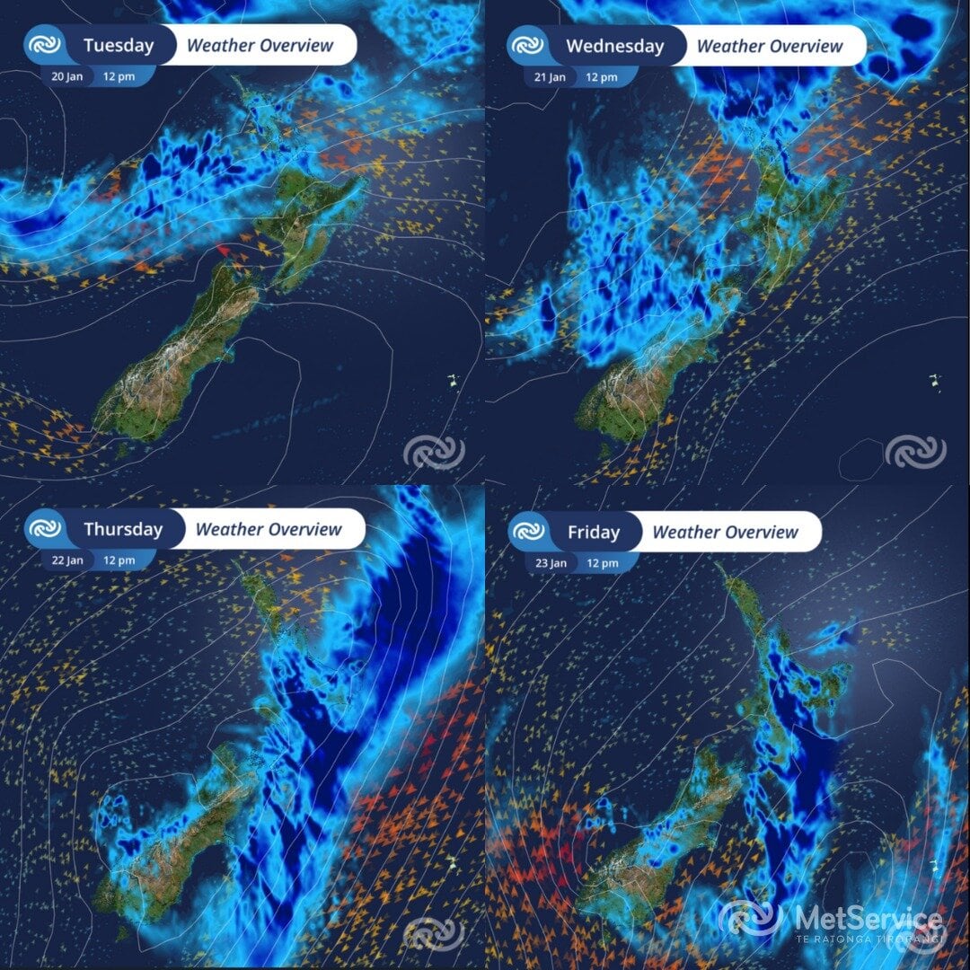
A weather overview for the next four days. Photo / MetService

0 comments
Leave a Comment
You must be logged in to make a comment.