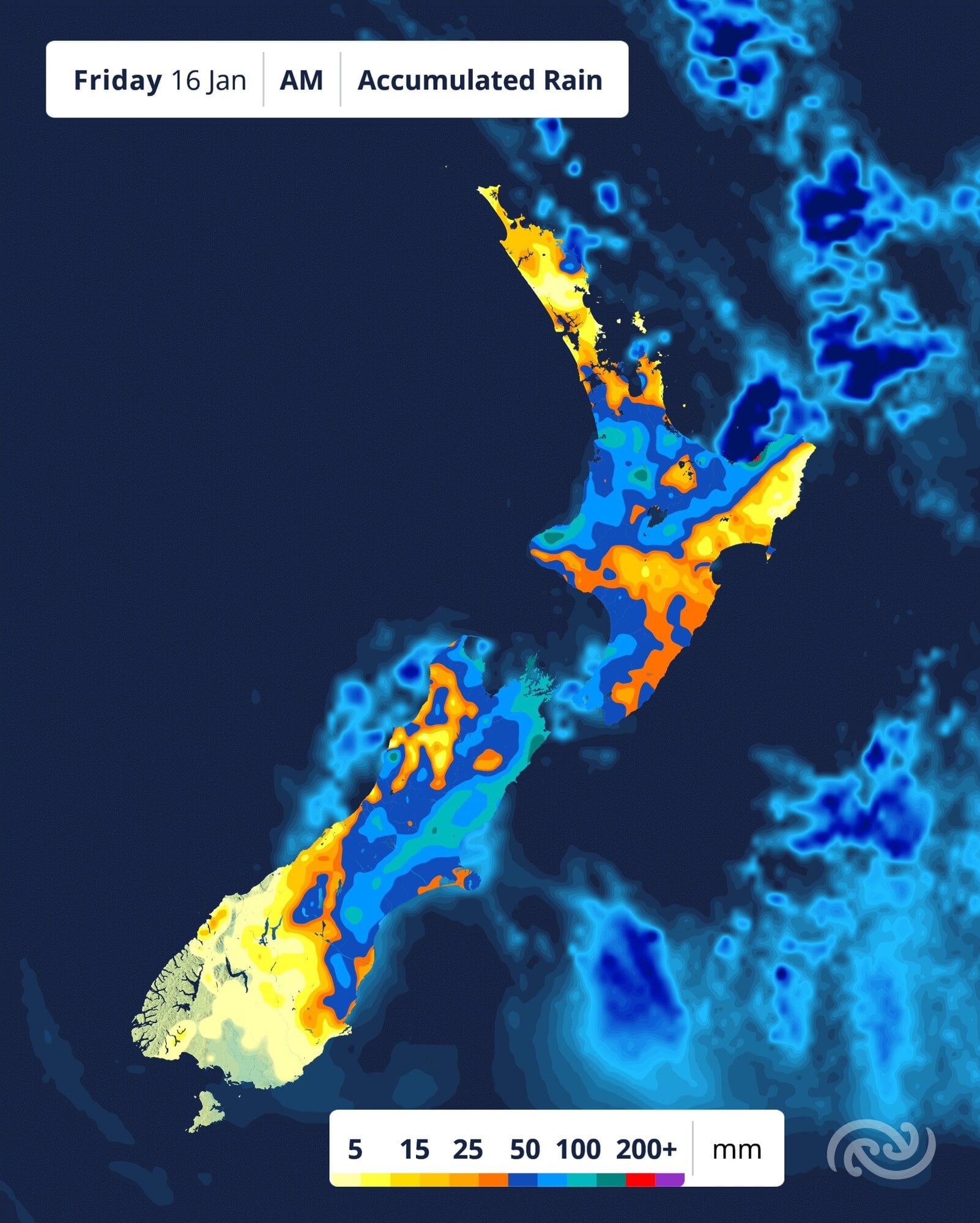
Heavy rain, downpours and thunderstorms are on the cards for the North Island some of today as an active low from the west moves over the country.
The MetService said things ease somewhat in the following couple of days but not a full return to settled summer weather everyone’s hoping for.
Yesterday saw most action for the North Island.
Bay of Plenty and Rotorua are under an orange heavy rain warning until 11am Friday, as well as Taranaki Maunga until 11pm tonight.
Auckland, Waikato, Waitomo, Taumarunui, Tongariro National Park, Kapiti/Horowhenua and Wellington are under yellow heavy rain watches.
Severe thunderstorm watches are in place for the remainder of the North Island, with the exception of Gisborne and Northern Hawke’s Bay.
However, severe thunderstorms and downpours are also a risk for the areas with Heavy Rain Watches and Warnings.
This means that most areas have the possibility to see severe thunderstorm warnings issued today, MetService meteorologist Katie Lyons said.
“Many areas in the North Island have broadscale heavy rain today, but on top of that, those areas also have the risk of localised shorter-lived downpours.
“Both of these can cause flooding, with the downpours often tipping it over the edge.”
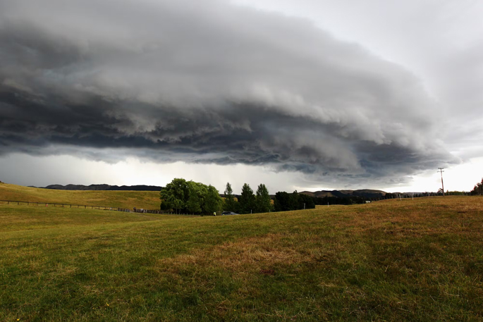
Heavy rain is forecast for the region for most on Friday. Image / MetService
This system will gradually move off to the east tomorrow, but not before giving a risk of thunderstorms for Eastern Bay of Plenty, Gisborne, and Wairarapa.
The South Island also has it’s own set of Heavy Rain Watches and Warnings today.
Northern Marlborough is under an Orange Heavy Rain Warning until 5pm today, with Yellow Heavy Rain Watches for the Tasman, Nelson, southern Marlborough, and northern Canterbury regions.
“Rain and showers spread across the remainder of the South Island today and tomorrow, with a multiday stint of overcast and rainy conditions starting for the east coast,” Lyons said.
Rain becomes mainly confined to eastern and far north areas over the next couple of days, as our broadscale setup changes to a high pressure system to the west-southwest, and easterly winds set to prevail across the country.
While the action dies down over the next couple of days, unfortunately it’s not the beautiful, hot, clear-skied summer, Lyons said.
After the warmer temperatures last week, these coming days will feel much chillier, particularly around NZ’s east coasts.
Maximums for Napier and Gisborne will struggle to reach 20°C from Saturday, with Canterbury maximums sitting around 15°C.
“Peering ahead for Wellington Anniversary Day, Kapiti and Horowhenua up through Whanganui look to be sunnier than Wellington itself, so a road trip and beach day may be on the cards for Monday,” Lyons said.

0 comments
Leave a Comment
You must be logged in to make a comment.